
Standard Map of Redwood County Minnesota
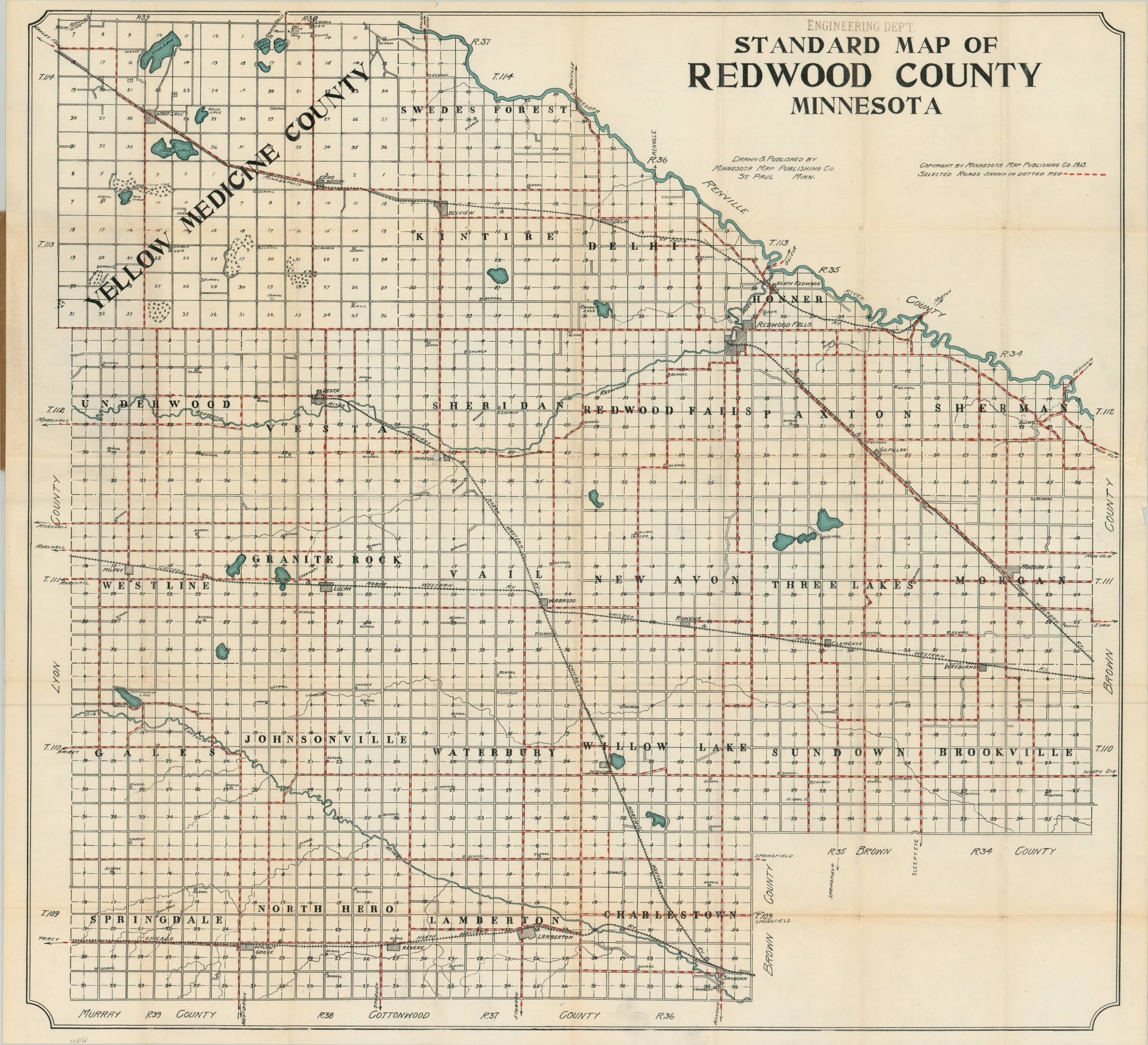
An early road map of a county in southeastern Minnesota.
Out of stock
Description
This highly functional map of Redwood County, Minnesota was designed and published in St. Paul by the Minnesota Map Publishing Company in 1913. Hashed red lines show ‘selected roads’ (presumably those with the best surface conditions), while schools, churches, towns, and railroads are also noted throughout the image.
The Minnesota River (upper right) and numerous small bodies of water are highlighted in blue, lending authority to the state’s claim as ‘The Land of 10,000 Lakes.’ Contemporary advertisements are present on the paper covers, including a list of other similar county maps issued by the same firm.
Map Details
Publication Date: 1913
Author: Minnesota Map Publishing Company
Sheet Width (in): 30
Sheet Height (in): 27.5
Condition: B+
Condition Description: Pocket map folded into 40 segments and affixed to original brown paper wrappers. Covers are moderately worn and the spine is torn, but intact. The sheet is also toned and somewhat brittle from age. Separation and discoloration has occurred in several areas along fold lines, but without any significant image loss or distraction from the image. 'Engineering Department' rubberstamp in the upper right, above the title.
Out of stock