Chicagorama
Original price was: $350.00.$250.00Current price is: $250.00.
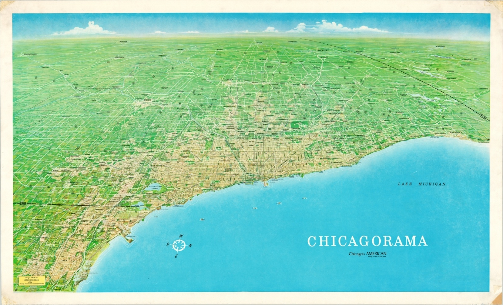
Chicago’s vast metropolis in the early 1960’s.
1 in stock
Description
Stretching from the United States Steel Mills near Gary, Indiana to Waukegan in the North Shore, this panoramic view of ‘Chicagoland’ captures the enormous stretch of urban density along Lake Michigan’s southwestern shore. Oriented with west at the top, it includes areas as far out as Bloomington, Peoria, Rockport, and Madison, Wisconsin.
Major transportation routes, neighborhoods, locations of interest, and local industries are individually labeled atop a largely nondescript illustration that visually separates the city from the surrounding countryside. Infrastructure improvements like the bobbing water cribs, expressway system, airports, and canals provide a physical link with Chicago’s history and the promise of its future.
The image was illustrated by Homer Grooman and published in Chicago by the American Publishing Company in 1961.
Map Details
Publication Date: 1961
Author: Homer Grooman
Sheet Width (in): 39.9
Sheet Height (in): 24.1
Condition: A-
Condition Description: Old tape residue in each corner, along with scattered spotting and soiling in the outer margins. Image remains clean on an otherwise intact sheet. Very good.
Original price was: $350.00.$250.00Current price is: $250.00.
1 in stock