
[The Wonderground Map]
$2,500.00
The second edition of MacDonald Gill’s groundbreaking cartographic design for London’s Underground.
1 in stock
Description
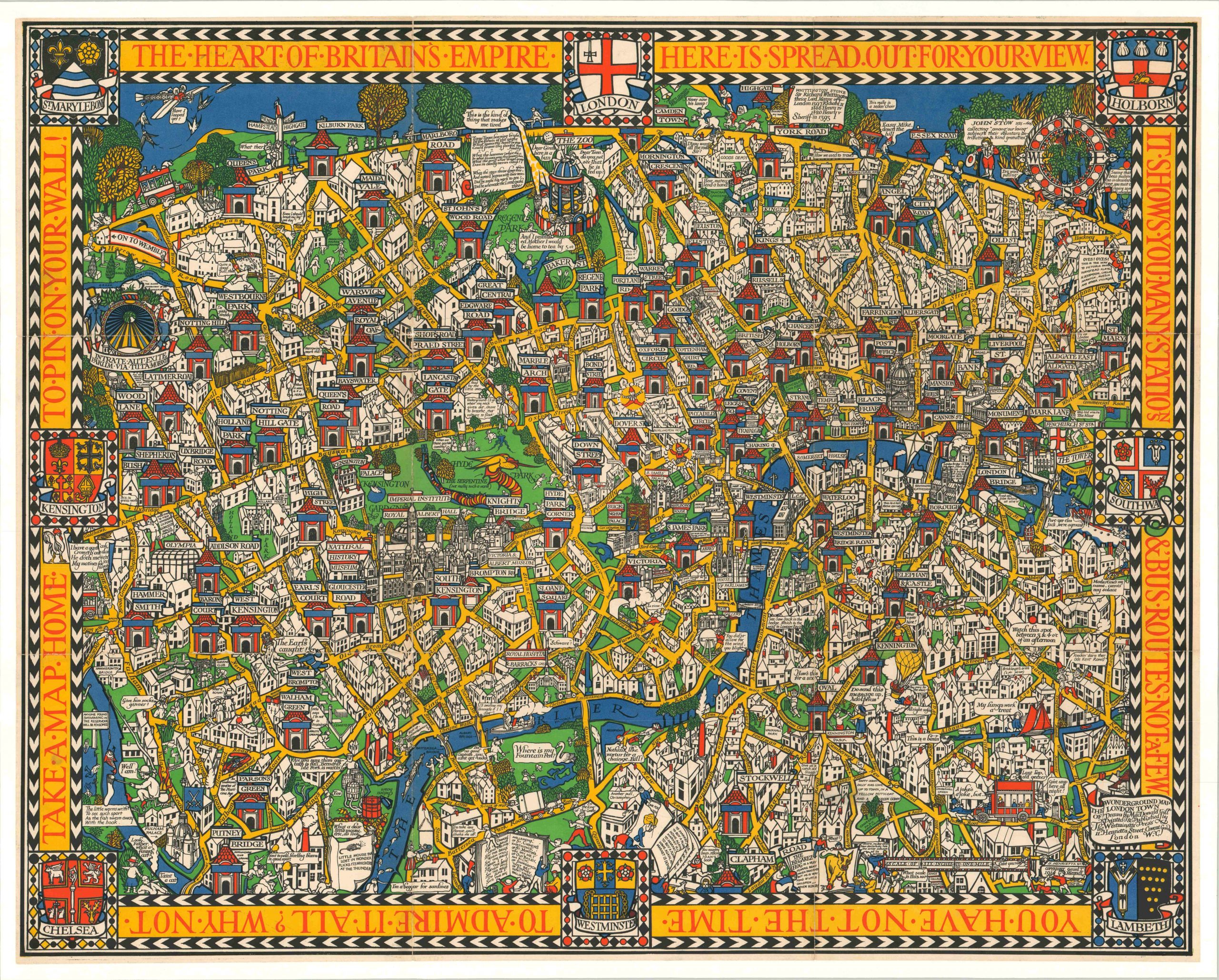
This magnificent pictorial map of London was first published during World War I by English artist MacDonald “Max” Gill. It was commissioned by the London Electric Underground Railway Company for advertising purposes and to entertain and inform passengers as they waited at stations.
This particular example, the second edition, was likely printed in 1924 to promote the British Empire Exhibition, held at Wembley Park. (Note the Imperial Lion and note in the upper left ‘On to Wembley”).
[From Picturing America]
“A storybook pictorial map of central London showing the location of Underground stations, the Wonderground Map was published in 1914, becoming an immediate success and ultimately the most influential pictorial map ever published. It was so popular that a smaller, folded version, with its own colorful envelope was produced. By the 1930’s the map was being retailed in the United States…Gill’s Wonderground Map introduced themes that would be copied and developed in American pictorial maps more than a decade later.”
These themes, the author continues to explain, include four principal elements. The heavy use of primary colors is one, notably yellow for roads and blue for water. Famous landmarks are depicted somewhat stylistically, but are certainly recognizable. Underground stations, on the other hand, are represented with small temples. The inclusion of people, animals, decorative elements and fantastic beasts provide both a level of general amusement and interest, in addition to a cultural association with the past, especially the medieval era. Finally, the map included a variety of text, much of it humorous. Bits of Olde English poetry, modern puns, and direct passages from Gill to the audience provide a depth of engagement that resulted in enormous popular appeal.
References:
Barron, Roderick, The Wonderground Map of London Town Drawn by MacDonald Gill.
Hornsby, S. J. (2017). Picturing America: The Golden Age of Pictorial Maps (Illustrated ed.). University of Chicago Press.
Map Details
Publication Date: 1924
Author: MacDonald Gill
Sheet Width (in): 36.75
Sheet Height (in):
Condition: A-
Condition Description: Formerly issued folded into 9 segments, now professionally mounted on linen for preservation and stability. Light creasing and wear along former fold lines have resulted in faint seams along the image, visible most obviously on the left side. Very small bits of image loss on a few of these seams, but otherwise the map is in very good condition and retains its vibrant printed color.
$2,500.00
1 in stock