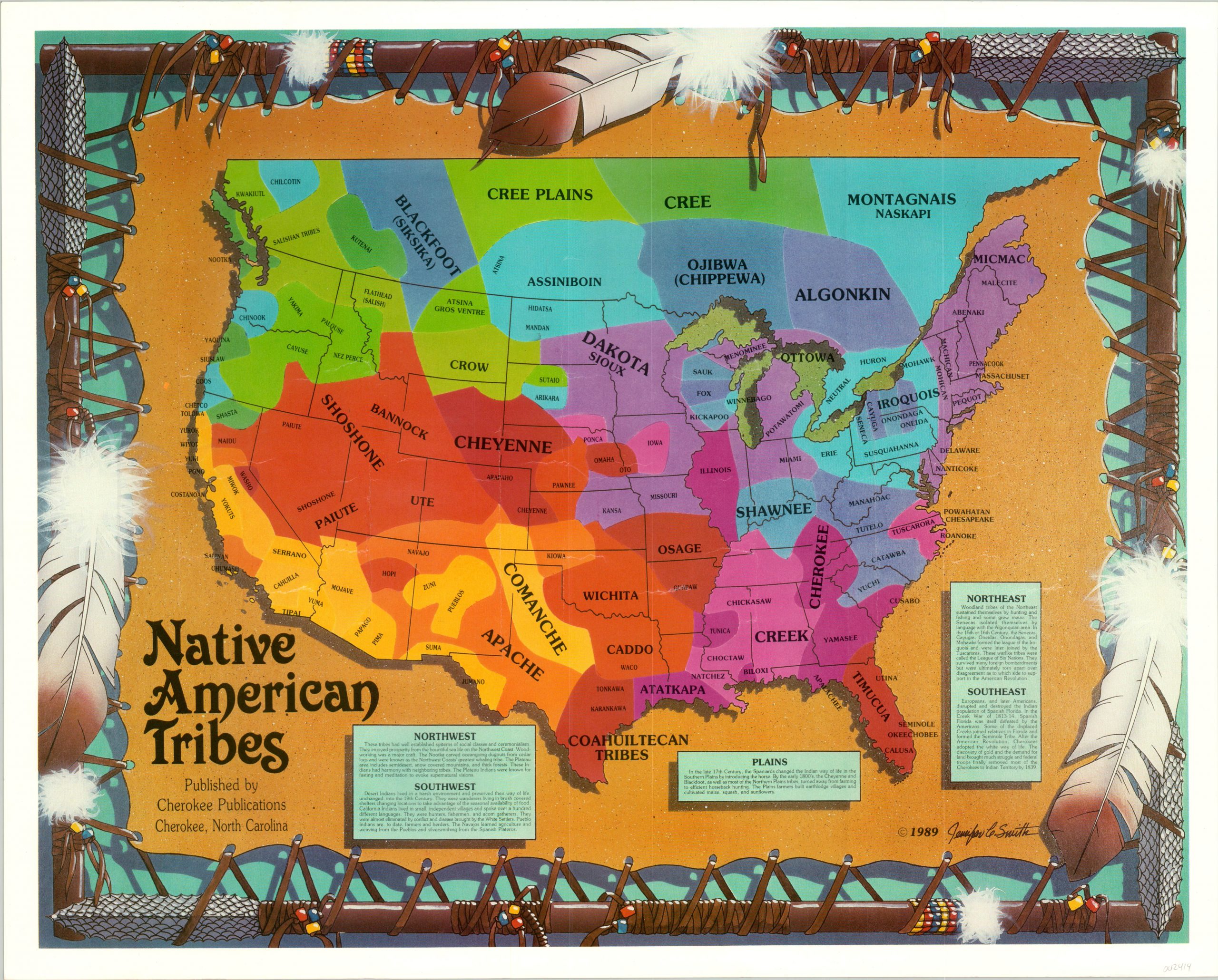
Native American Tribes
Colorful, if oversimplified, summary of the historical presence of Native Americans across the U.S.
Out of stock
Description
This eye-catching map of the United States and a sliver of southern Canada purports to show the historical location of Native American tribes. Bright colors defining specific territories are labeled with the names of various tribes; including the Iroquois Confederacy, Plains Indians, and the myriad of groups in the Pacific Northwest. Accompanying text generalizes each region, though it fails to provide some of the much needed context behind the content of the map.
Few tribes actually respected the concept of ‘land ownership’, and the affiliation and geographic location of various bands could change drastically. As one example, the Sioux (shown in their ‘original’ lands at the headwaters of the Mississippi) would eventually be pushed out of the region by the encroachments of the French. They would migrate further west, eventually occupying the Black Hills – the site best known as their homeland today.
The image was drawn by Jennifer Smith and published in 1989 by Cherokee Publications of Cherokee, North Carolina. This small, census-designated town sits on the far edge of the Eastern Cherokee Reservation, likely making this a publication of indigenous origin.
Map Details
Publication Date: 1989
Author: Jennifer Smith
Sheet Width (in): 19.70
Sheet Height (in): 11.5
Condition: A-
Condition Description: Minor edge wear and some extraneous creasing from where the map was previously rolled.
Out of stock