
64th Operational Report
A detailed overview of how mapmaking helped to win the war in the Pacific.
Out of stock


Description
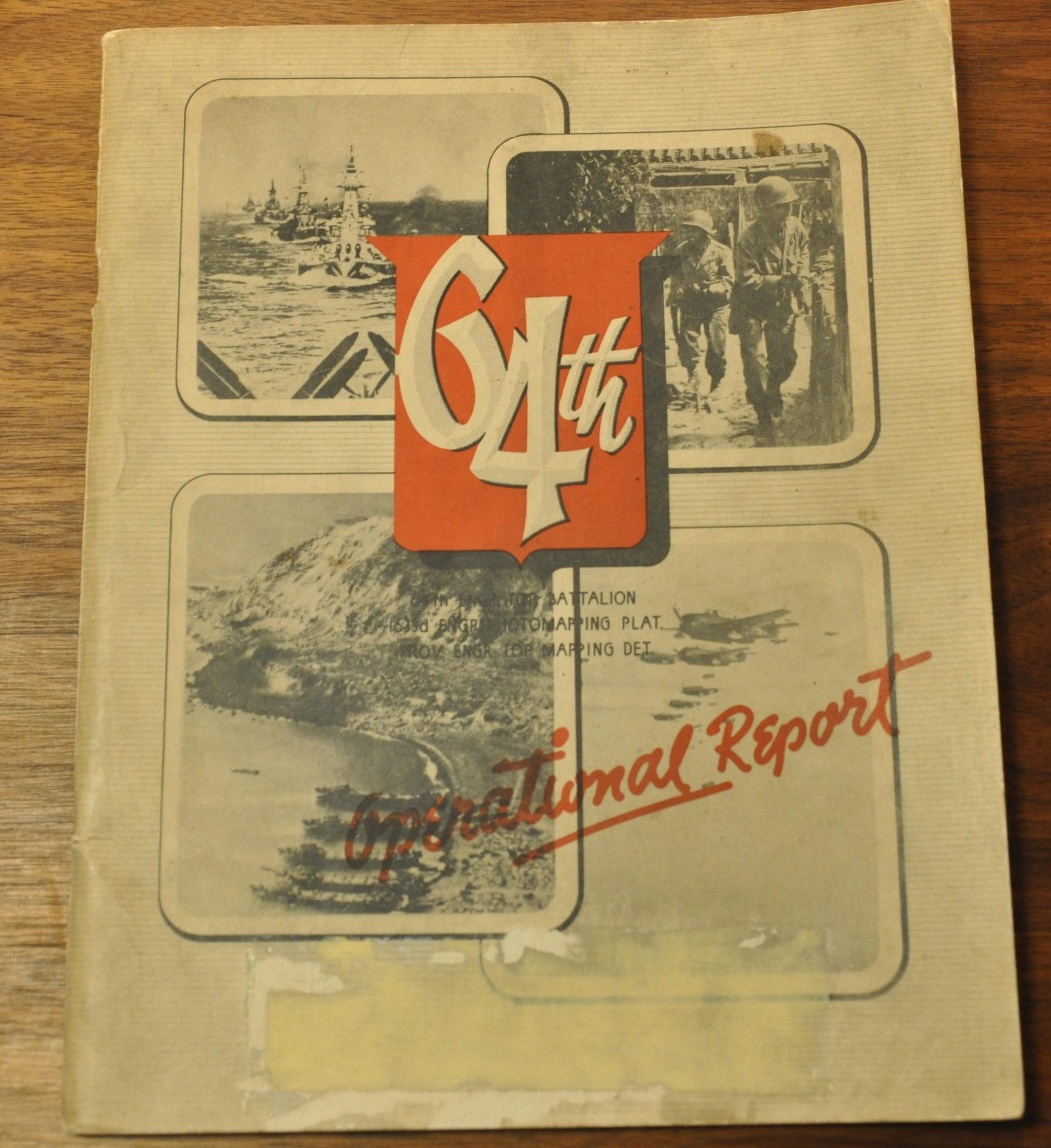
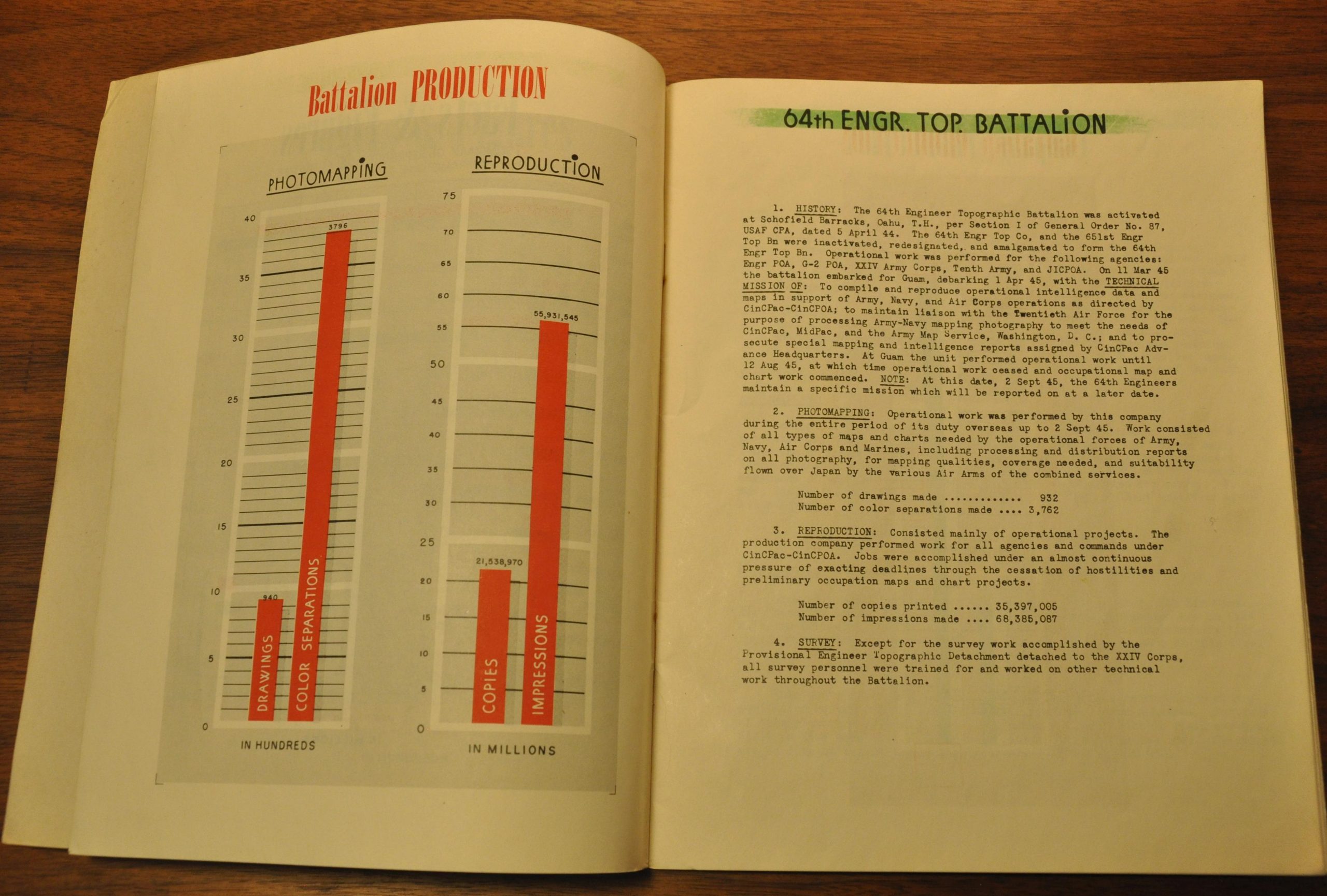
This fascinating operational report details the World War II experience of the 64th Engineer Topographic Battalion between July of 1942 and September of 1945. During that period, the battalion and other contributing units provided maps and other intelligence information ‘wholly or in part for every major land and air campaign in the Pacific, with the exception of the Western New Guinea area’ (according to the introduction by the commanding officer, Lt. Col. M.C. Shetler).
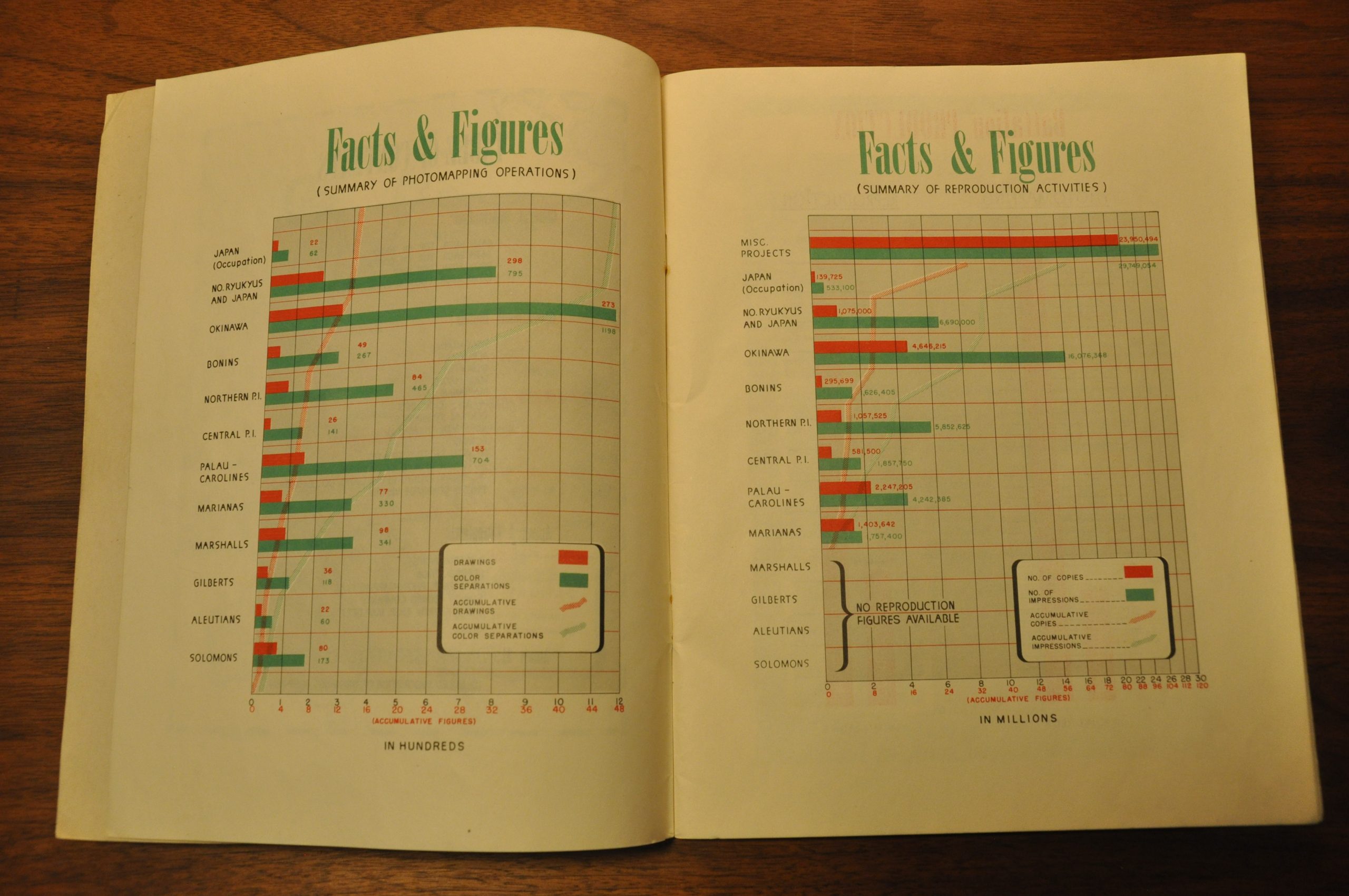
The following 60 pages provide a fascinating behind-the-scenes look at how one critically important support battalion contributed to ultimate victory over the Japanese. A lengthy unit history, maps of the various operational areas covered, diagrams detailing production output, and summaries of major campaigns give tremendous context to the role that topographic engineers played during the war, especially in the Pacific Theater.
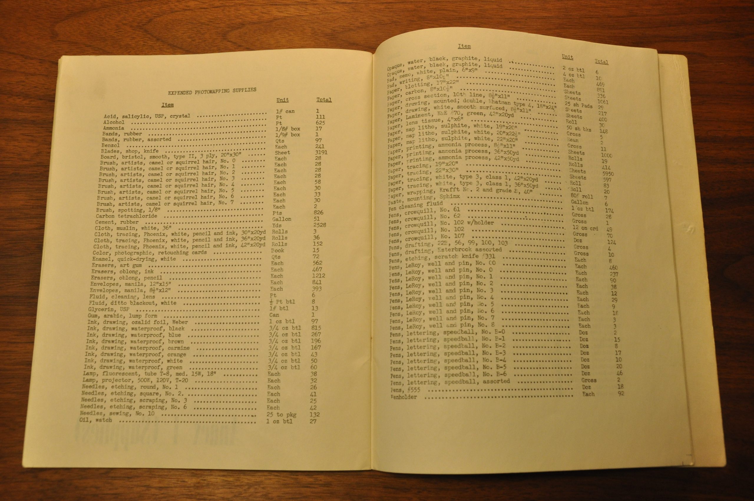
The final ten pages contain a detailed index of the supplied expended during the campaign. Such totals include 275 gallons of turpentine, 1,308 lbs. of black lithographic ink, 12,623 reams of wet strength paper, 700 incandescent lamps, and much, much more.
Map Details
Publication Date: 1945
Author: 64th Engineer Topographic Battalion
Sheet Width (in): 8
Sheet Height (in): 10.1
Condition: A-
Condition Description: Complete, 62 pp., but missing supplemental annex. Tight stapled binding with original pictorial paper covers, heavily soiled. Contents are generally very good, with a few dirty fingerprints in the margins.
Out of stock