
Go U.S. 40… The All Year Travel Highway
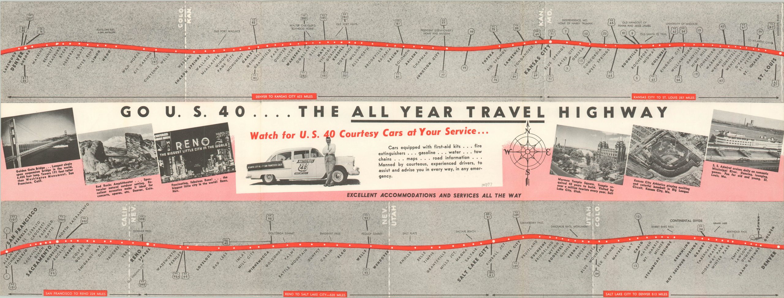
Folding strip style road map of the ‘Main Street of America.’
Out of stock
Description
Originally created in 1926 to connect Atlantic City, New Jersey to San Francisco, California, U.S. Highway 40 traversed the whole country across fourteen different states. Although today a portion of the western route has been replaced by Interstate 80, many of the attractions presented on this map can still be seen today.
The image shows the highway route in a strip map style from St. Louis to San Francisco, with various stopover towns and important intersections identified along the way. Photographs of notable landmarks, historic sites, and outdoor activities are shown in the center of the map, and on the verso of the sheet. The verso also contains a mileage chart for eastbound and westbound destinations along U.S. Highway 40.
Map Details
Publication Date: c. 1955
Author: National U.S. 40 Association
Sheet Width (in): 27.20
Sheet Height (in): 10.25
Condition: A
Condition Description: Faint wear and creasing along originally issued fold lines, otherwise in fine condition.
Out of stock