
Mediterranean Map Showing Steampship, Railway, and Air Routes
$219.00
A transportation overview of Europe and the Mediterranean emphasizing the connectedness of fascist Italy.
1 in stock
Description
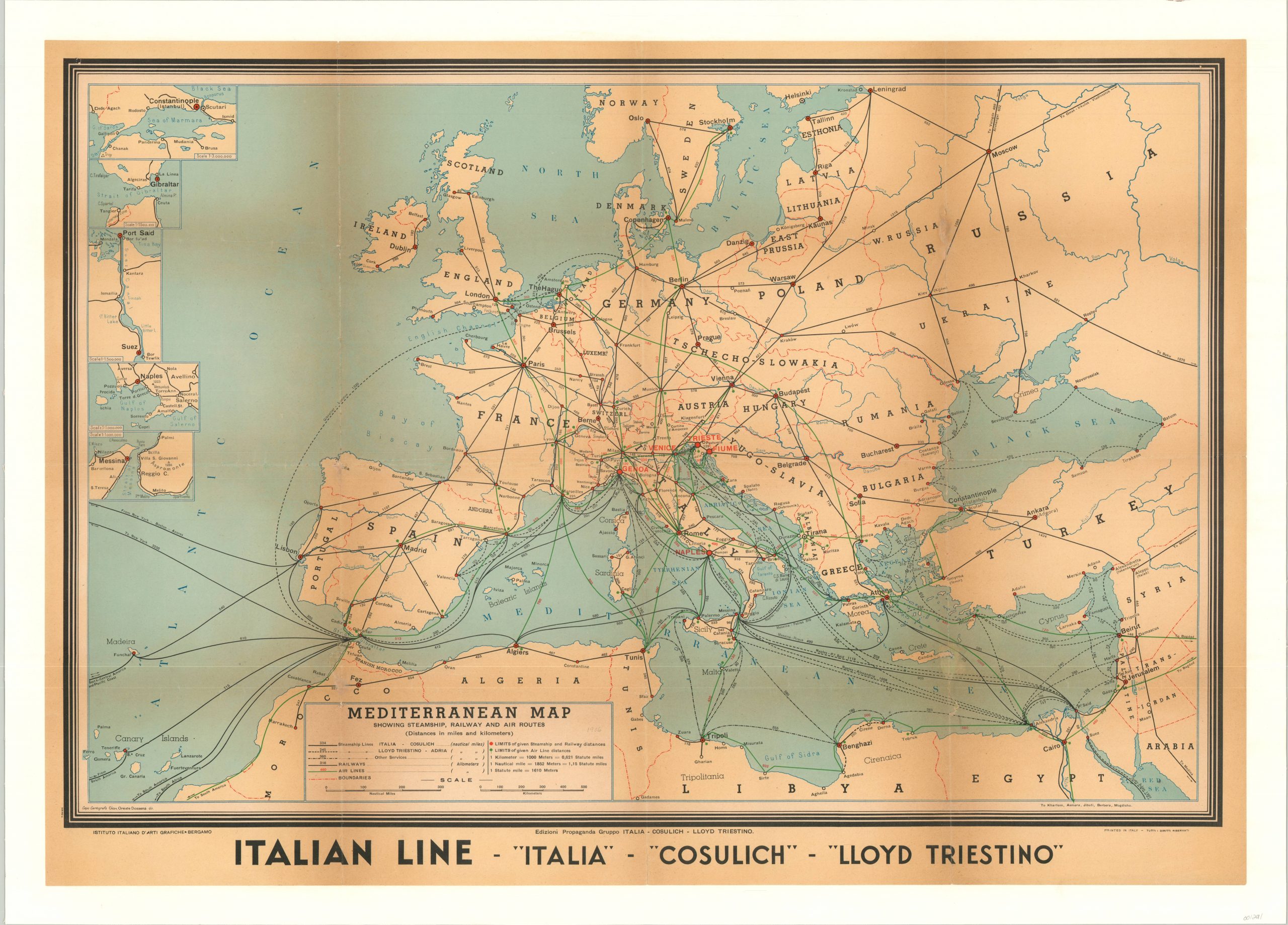
Though humbly titled a “Mediterranean Map”, this image covers the entirety of Europe, north Africa, and parts of eastern Asia. It shows a complex network of transportation routes connecting major metropolitan areas just a few years before the outbreak of World War II.
The emphasis is on the numerous steamship routes offered by the Italian Lines, which allowed for easy travel from four main departure ports in Italy to nearly anywhere in the world. Five inset maps of major maritime features accessed by these routes outline in detail the Bosporus, Strait of Gibraltar, Suez Canal, Gulf of Naples, and Strait of Messina. In addition to water transportation, the map also shows railroads and major air routes, many of which also can be seen emanating from Italy.
Transportation technology and efficiency, especially in the world of aviation, became a hallmark of Mussolini’s Fasisct Italy. The map was designed at the Instituto Italiano D’Arti Grafiche in Bergamo and printed by Tutti Diritti Riservati. Published by Edizioni Propaganda Gruppo Italia, Cosulich, Lloyd Triestino.
Map Details
Publication Date: 1936
Author: Istituto Italiano D'Arti Grafiche
Sheet Width (in): 38.10
Sheet Height (in): 26.90
Condition: B+
Condition Description: Originally folded into twelve panels, now mounted onto linen for preservation and stability. Some breaking and discoloration along fold lines, including faint image loss. A few spots of wear visible, but overall in very good condition.
$219.00
1 in stock