
A New and Exact Plan of Dunkerk
$65.00
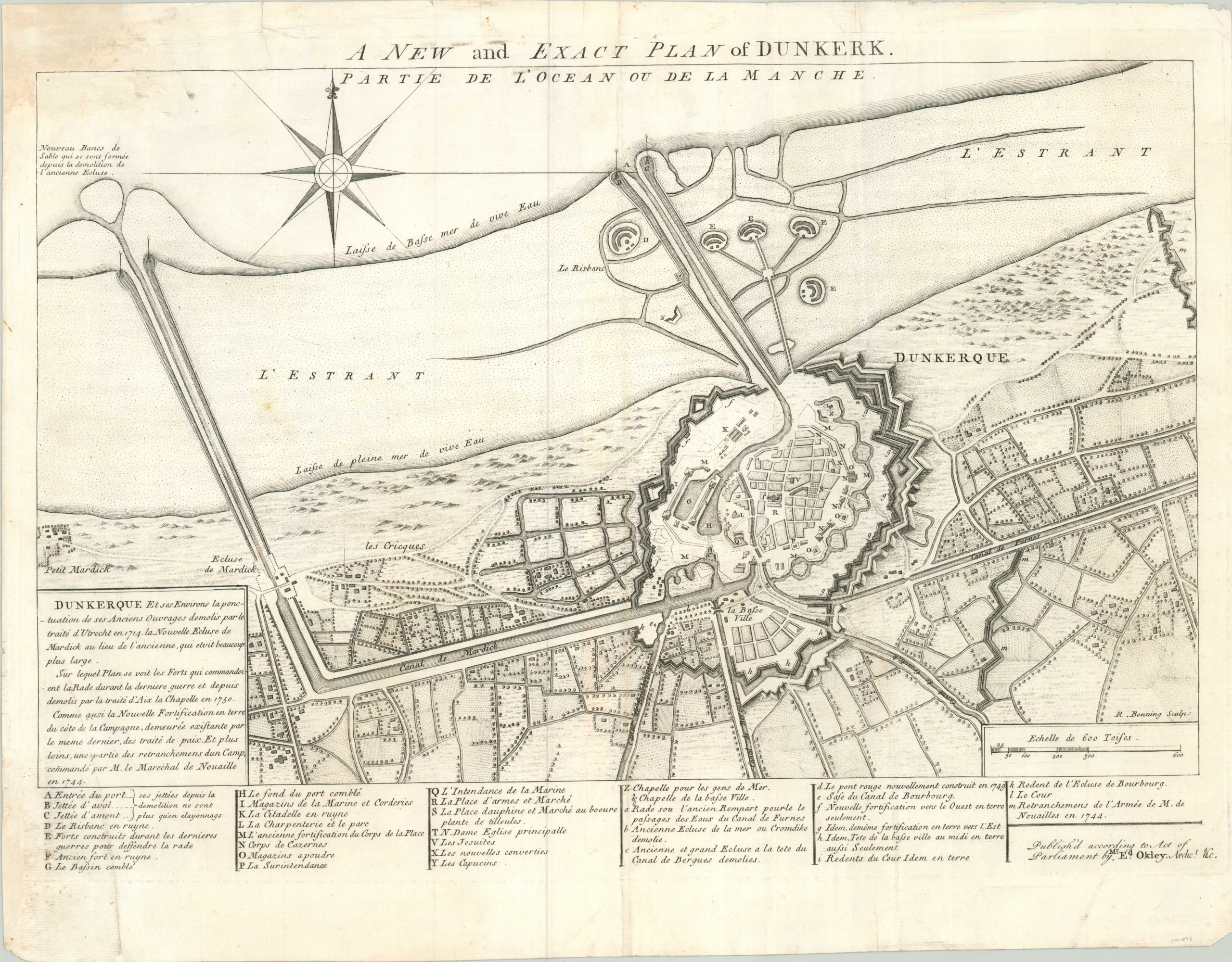
English version of a plan of Dunkirk issued shortly before the outbreak of the Seven Year’s War.
1 in stock
Description
The French port of Dunkirk was on the minds of Englishmen long before its beaches became famed for the evacuation during World War II. This plan shows the orientation of fortifications in the middle of the 18th century, after they had been destroyed and rebuilt as a result of several treaties in earlier decades.
Thirty five separate points of strategic military interest are identified in the legend along the bottom of the sheet, while the map itself shows a heavily fortified city center surrounded by rolling hills and the bocage that would also become famous during WWII. Engraved by R. Benning and published by Mr. Edward Oakley.
Map Details
Publication Date: c. 1755
Author: Edward Okley
Sheet Width (in): 20.30
Sheet Height (in): 15.60
Condition: B+
Condition Description: Moderate wear and soiling in the top left third of the sheet, including a few marginal tears that have been repaired on the verso. Some discoloration visible in the lower left corner of the sheet as well.
$65.00
1 in stock