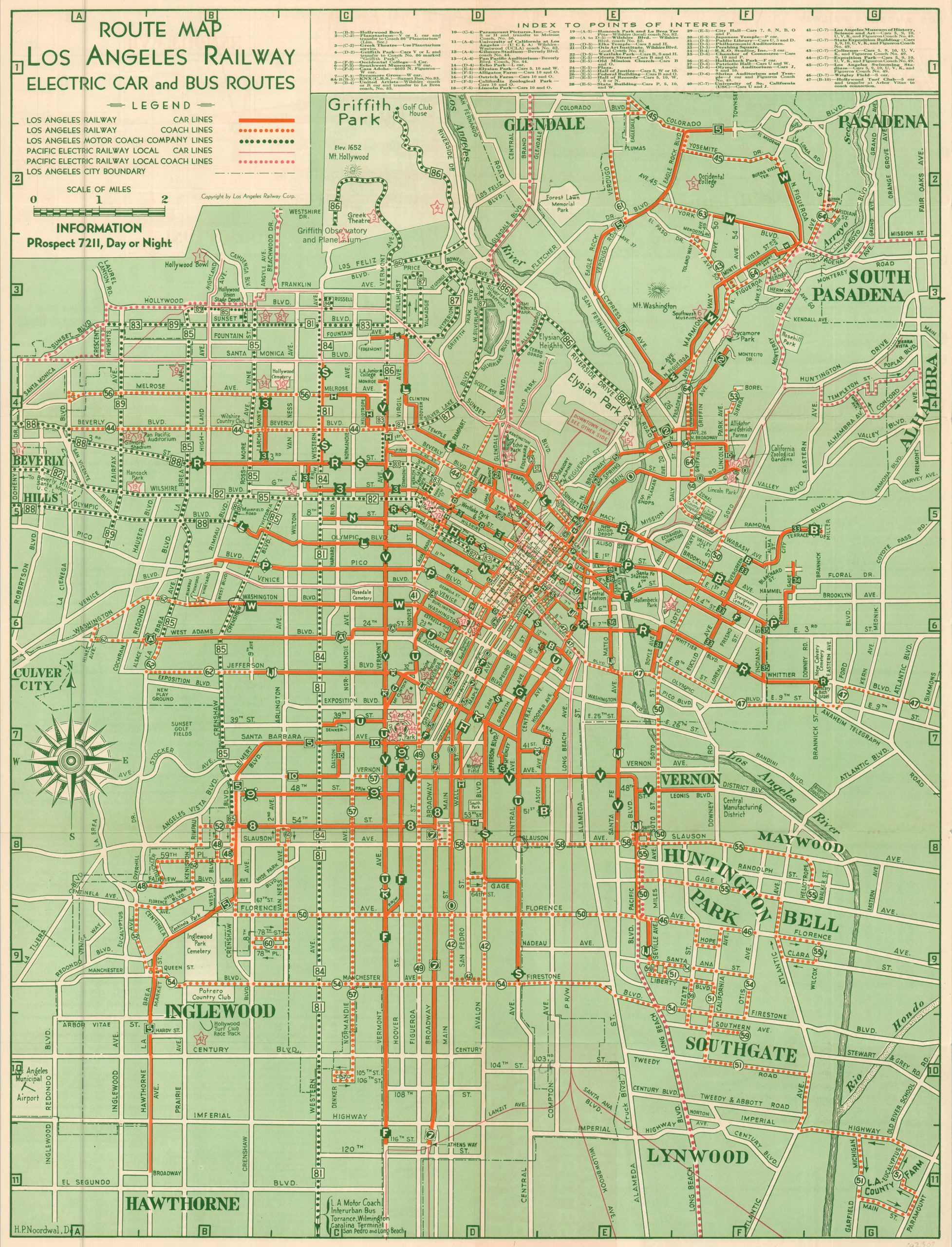
Route Map Los Angeles Railway Electric Car and Bus Routes
A prewar look at the changing transportation scene in Los Angeles.
Out of stock
Description
Despite the image of being dominated by freeways and traffic jams today, the commuters of Los Angeles formerly preferred rails over roads. This map shows the citywide transportation network as of June, 1938 and covers between Griffith Park in the north and Hawthorne in the south.
Railway and bus lines operated by the primary transportation providers; the Los Angeles Railway, Motor Coach Company, and the Pacific Electric Railway, are identified according to the legend underneath the title. A cramped index to places of interest is listed across the top, and the verso includes further information on local transportation routes operated by the Los Angeles Railway.
Map Details
Publication Date: 1938
Author: Los Angeles Railway Corporation
Sheet Width (in): 17.25
Sheet Height (in): 22.75
Condition: A
Condition Description: Originally issued folded into 12 panels, with light creasing along former fold lines. Very good to near fine overall.
Out of stock