U.S. Midwest
Showing 973–990 of 1692 resultsSorted by latest
-

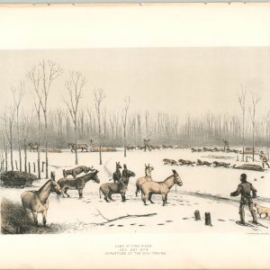
Camp at Pine Ridge Dec. 22 1873 Departure of the Dog Trains
$20.00 Quick View -
Report of the Commissioner of Corporations on Water-Power Development in the United States
$575.00 Quick View -
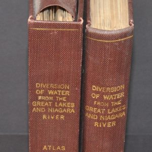
Diversion of Water from the Great Lakes and Niagara River
$250.00 Quick View -
Sold Out
Report of the Board of Engineers on Deep Waterways Between the Great Lakes and the Atlantic Tidewaters
Quick View -
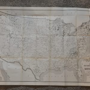
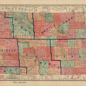
North Dakota
$195.00 Quick View -
Sold Out
East Sectional View of Copper Falls Mine
Quick View -
Sold Out
The ‘Father of Waters’ [Mississippi River]
Quick View -
Sold Out
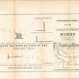
Underground Works of the Northwest Mines
Quick View -
Sold Out
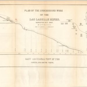
Plan of the Underground Work of the Lac Labelle Mines
Quick View -
Sold Out
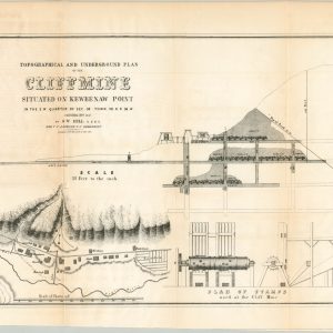
Topographical and Underground Plan of the Cliff Mine Situated on Keweenaw Point
Quick View -
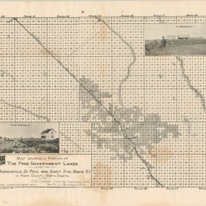
Map Showing A Portion of the Free Government Lands Along the Minneapolis, St. Paul and Sault Ste. Marie Railway
$195.00 Quick View -
Sold Out
[William H. Brown & Co. Lands in North Dakota]
Quick View -
Sale!
Sold Out
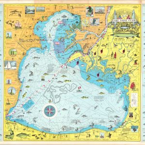
Fishing Chart of Lake Saint Clair
Quick View -
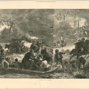
A Forest Fire in America
$80.00 Quick View -
Sale!
Etats Unis Partie Nord Ouest [Title on Verso]
$1,400.00Original price was: $1,400.00.$1,150.00Current price is: $1,150.00. Quick View -
Owen’s Geological Survey of Wisconsin, Iowa, and Minnesota
$600.00 Quick View -
Sale!
Sold Out
[Maps of the Ohio Boundary Question – The Toledo War]
Quick View -
Sold Out
[Geologic Maps of Michigan’s Upper Peninsula]
Quick View


![The 'Father of Waters' [Mississippi River]](https://curtiswrightmaps.com/wp-content/uploads/DSC_0959-1-300x300.jpg)
![[William H. Brown & Co. Lands in North Dakota]](https://curtiswrightmaps.com/wp-content/uploads/map_300dpi_21.83x15.99_inv4038c-300x300.jpg)
![Etats Unis Partie Nord Ouest [Title on Verso]](https://curtiswrightmaps.com/wp-content/uploads/map_300dpi_25.18x29.11_inv4001.c-300x300.jpg)
![[Maps of the Ohio Boundary Question - The Toledo War]](https://curtiswrightmaps.com/wp-content/uploads/map_300dpi_26.50x52.27_inv3994.3c-1-e1656685029763-300x300.jpg)
![[Geologic Maps of Michigan's Upper Peninsula]](https://curtiswrightmaps.com/wp-content/uploads/map_300dpi_26.01x20.21_inv3993.7c-1-300x300.jpg)
show blocks helper