St. Louis
Showing 1–18 of 56 resultsSorted by latest
-
![[Electoral Broadside from the 1920 Presidential Election]](data:image/svg+xml,%3Csvg%20xmlns='http://www.w3.org/2000/svg'%20viewBox='0%200%20300%20300'%3E%3C/svg%3E)
[Electoral Broadside from the 1920 Presidential Election]
Quick View -
Missouri
$125.00 Quick View -
Onondaga Cave [Missouri]
$30.00 Quick View -
Tourist Satellite View Map of Missouri
$40.00 Quick View -
St. Louis Central Traffic-Parkway Recommended by the City Plan Commission
$125.00 Quick View -
U.S. 50 – Famous Fifty – Coast to Coast the Central Pleasure Route
$95.00 Quick View -
The Vietnam Area
$110.00 Quick View -
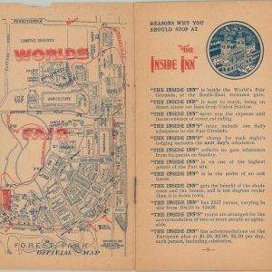
How to Secure accommodations at the “Inside Inn” – The Only Hotel within the Ground of the World’s Fair St. Louis U.S.A. 1904
Quick View -
Phelps’ Hundred Cities and Large Towns of America, with Railroad Distances Throughout the United States, Maps of Thirteen Cities, and Other Embellishments
$425.00 Quick View -
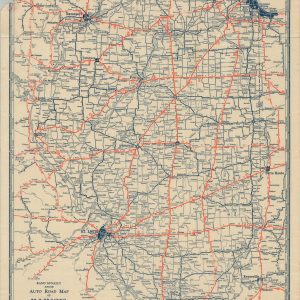
Rand McNally Junior Auto Road Map of Illinois
$45.00 Quick View -
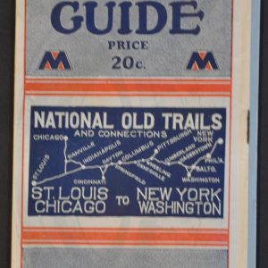
Mohawk Hobbs Grade and Surface Guide National Old Trails and Connections
$175.00 Quick View -
Six Flags Over Mid America
$150.00 Quick View -
Sale!
Mitchell’s National Map of the American Republic or United States of North America.
Original price was: $450.00.$375.00Current price is: $375.00. Quick View -
The City of St. Louis
$40.00 Quick View -
Southwestern Region 1958 Main Line Track Program
$95.00 Quick View -
St. Louis
$145.00 Quick View -
The Four Quarters of the Globe
$75.00 Quick View -
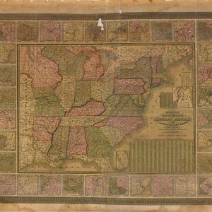
[Parts of Missouri and Illinois during the American Civil War]
$75.00 Quick View
![[Electoral Broadside from the 1920 Presidential Election]](https://curtiswrightmaps.com/wp-content/uploads/map_22.02x34.21_02-17-26_inv008130c-300x300.jpg)
![Onondaga Cave [Missouri]](https://curtiswrightmaps.com/wp-content/uploads/map_10.91x17.39_01-02-26_inv007981c-300x300.jpg)


![[Parts of Missouri and Illinois during the American Civil War]](https://curtiswrightmaps.com/wp-content/uploads/map_28.96x18.13_07-19-24_plate_clii-300x300.jpg)