Water
Maps focused on transportation and shipping by water.
Showing 1–18 of 383 resultsSorted by latest
-
![[Map of Balnibarbi, Lugnagg, and Glubdrubdrib]](data:image/svg+xml,%3Csvg%20xmlns='http://www.w3.org/2000/svg'%20viewBox='0%200%20300%20300'%3E%3C/svg%3E) Sold Out
Sold Out[Map of Balnibarbi, Lugnagg, and Glubdrubdrib]
Quick View -
Sold Out
[Map of Brobdingnag]
Quick View -
Sold Out
[Map of Balnibarbi]
Quick View -
Sold Out
Sebago Lake reached via Songo River & Bay of Naples Steamboat Company and Connections
Quick View -
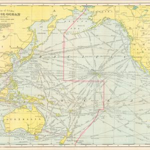
Map of the Pacific Ocean Showing Distances between Principal Points and the International Date Line
$250.00 Quick View -
La Rade de Gammeron [The Straits of Hormuz]
$250.00 Quick View -
Hudson River Day Line
$40.00 Quick View -
Carte de la Coste Occidentale D’Afrique Depuis le Cap Blanc Jusqu’a Tanit [with] A Map or Chart of the Coast of West Africa from Cape Blanco to Tanit, taken from Labat
$60.00 Quick View -
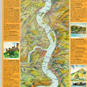
The Course of the Rhine from Mainz to Cologne
$45.00 Quick View -
Fast Motor Routes between New England and the South, the West and Atlantic Coast via the New Castle-Pennsville Ferry
$95.00 Quick View -
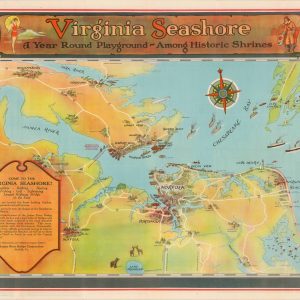
Virginia Seashore A Year Round Playground-Among Historic Shrines
$250.00 Quick View -
Russ Smiley’s Fishing Map of South Florida
$175.00 Quick View -
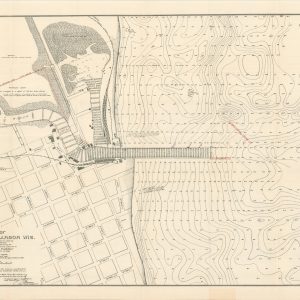
Map of Kewaunee Harbor, Wis.
$95.00 Quick View -
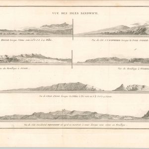
Vue des Isles Sandwich
$40.00 Quick View -
Shadowing at Henley Regatta
$45.00 Quick View -
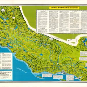
California Water Resources Development
$275.00 Quick View -
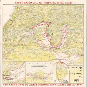
Map of the Great Lakes, Showing Route of D&C. Lake Lines
$125.00 Quick View -
Map of Travel Time to and From Europe via the Shorter St. Lawrence Seaway
$195.00 Quick View
![[Map of Balnibarbi, Lugnagg, and Glubdrubdrib]](https://curtiswrightmaps.com/wp-content/uploads/map_8.09x5.28_10-08-25_inv007688-300x300.jpg)
![[Map of Brobdingnag]](https://curtiswrightmaps.com/wp-content/uploads/map_8.08x5.13_10-08-25_inv007686-300x300.jpg)
![[Map of Balnibarbi]](https://curtiswrightmaps.com/wp-content/uploads/map_8.16x5.16_10-08-25_inv007685-300x300.jpg)

![La Rade de Gammeron [The Straits of Hormuz]](https://curtiswrightmaps.com/wp-content/uploads/map_8.69x13.55_08-19-25_inv007468c-300x300.jpg)

![Carte de la Coste Occidentale D'Afrique Depuis le Cap Blanc Jusqu'a Tanit [with] A Map or Chart of the Coast of West Africa from Cape Blanco to Tanit, taken from Labat](https://curtiswrightmaps.com/wp-content/uploads/Inv7445-300x300.jpg)


show blocks helper