World War II
Maps produced during the Second World War (1939 – 1945), including items covering themes preceding and following the conflict.
Showing 1–18 of 998 resultsSorted by latest
-
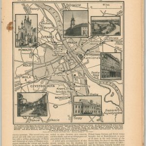
Warsaw Bombed & Burned to a Smoking Shambles
$95.00 Quick View -
 Sold Out
The Eleven Regional Federation Comprising the World Federation System
Quick View -

Scene of the European Turmoil
$100.00 Quick View -
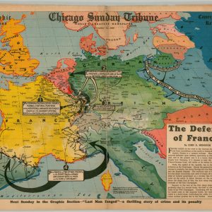
The Defense of France!
$80.00 Quick View -
![Blickin die Welt [A Look at the World]](https://curtiswrightmaps.com/wp-content/uploads/map_12.64x26.53_01-05-26_inv007867c-300x300.jpg)
Blickin die Welt [A Look at the World]
$345.00 Quick View -
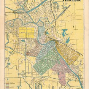
Map of Tientsin
$600.00 Quick View -

World Atlas War Edition
$60.00 Quick View -
![KNOW YOUR U.S.A. [WWII Volvelle]](https://curtiswrightmaps.com/wp-content/uploads/DSC_2438-1-300x300.jpg)
KNOW YOUR U.S.A. [WWII Volvelle]
$50.00 Quick View -

Drama in the West
$60.00 Quick View -
 Sold Out
The Map Maker
Quick View -
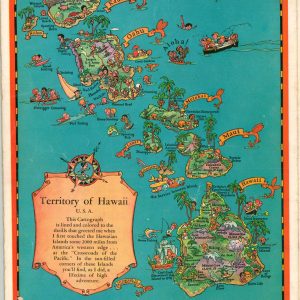
Colored Cartograph Map Folder with Aloha and Cordial Greetings from Hawaii U.S.A.
$200.00 Quick View -
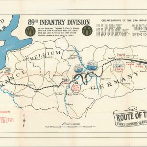
Route of the 89th France – Luxembourg – Germany
$275.00 Quick View -
 Sold Out
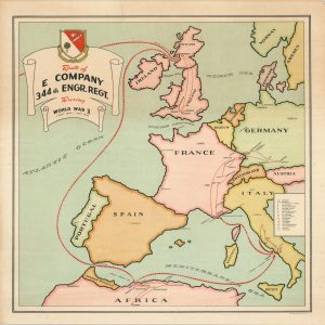
Route of E Company 344th Engr. Regt. During World War II
Quick View -
 Sold Out
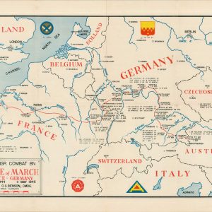
260 Engr. Combat Bn. Route of March France – Germany 24 Dec. 1944 11 May 1945
Quick View -
![[Collection of WWII Maps from the Chicago Daily Tribune]](https://curtiswrightmaps.com/wp-content/uploads/DSC_1587-1-300x300.jpg) Sold Out
Sold Out[Collection of WWII Maps from the Chicago Daily Tribune]
Quick View -
![AAF Cloth Chart - Philippine Series No. 41 Mindoro Island [and] No. 42 Samar Island](https://curtiswrightmaps.com/wp-content/uploads/map_27.71x36.78_04-15-25_inv006830c-300x300.jpg)
AAF Cloth Chart – Philippine Series No. 41 Mindoro Island [and] No. 42 Samar Island
$125.00 Quick View -
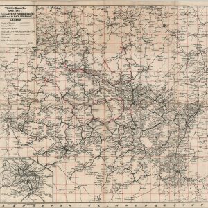
706 Ry. Grand Div. Eng. Sect. Railways of the Region De-l’Est and Alsace Lorraine
$175.00 Quick View -
News Commentator’s World Atlas
$45.00 Quick View
show blocks helper