Empire
Maps which show the territorial extent of historic empires.
Showing 1–18 of 1124 resultsSorted by latest
-
![Sac and Fox Lands Keokuk Reserve [Print Block]](data:image/svg+xml,%3Csvg%20xmlns='http://www.w3.org/2000/svg'%20viewBox='0%200%20300%20300'%3E%3C/svg%3E)
Sac and Fox Lands Keokuk Reserve [Print Block]
$175.00 Quick View -
Carte De La Louisiane Colonie Française avec le Cours du Fleuve St Louis [Print Block]
$275.00 Quick View -
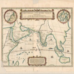
Erythraei Sive Rubri Maris Periplus
$300.00 Quick View -
A Memoir on the North-Eastern Boundary in Connexion with Mr. Jay’s Map
$375.00 Quick View -
Description de la Peche, Habillemens, Habitations, Manieres de Vivre, Superstitions et Autres Usages des Indiens de la Virginie
$250.00 Quick View -
Birds-Eye View of the Suez Canal Connecting the Red Sea with the Mediterranean
$100.00 Quick View -
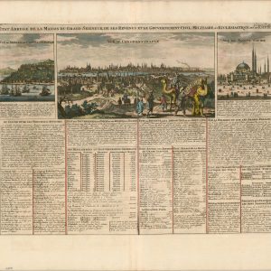
Etat Abrege de la Maison du Grand Seigneur, de ses Revenus et le Gouvernement Civil, Militaire, et Ecclesiastique de cet Empire.
$200.00 Quick View -
Britannia: Or a Chorographical Description of Great Britain and Ireland [Title Page]
$95.00 Quick View -
Indian Villages of the Illinois Country
$125.00 Quick View -
Sold Out
Atlas to Marshall’s Life of Washington
Quick View -
Map Showing the Progress of the Public Surveys in Kansas and Nebraska
$125.00 Quick View -
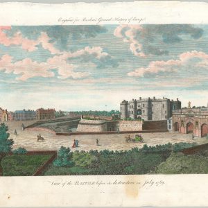
View of the Bastille before its destruction in July 1789
$145.00 Quick View -
Andrees Allgemeiner Handatlas
$275.00 Quick View -
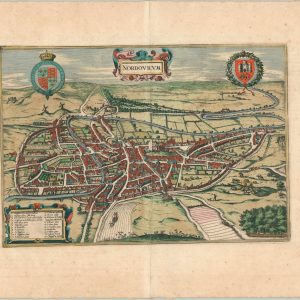
Nordovicum
$295.00 Quick View -
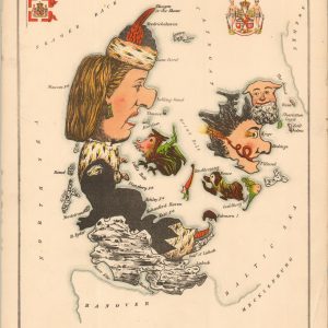
Denmark
$375.00 Quick View -
A Map of New-England [1826 reprint]
$300.00 Quick View -
Sold Out
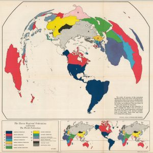
The Eleven Regional Federation Comprising the World Federation System
Quick View -
A Brief Description of the Birds Eye View of the Madura Town
$500.00 Quick View
![Sac and Fox Lands Keokuk Reserve [Print Block]](https://curtiswrightmaps.com/wp-content/uploads/DSC_2704-300x300.jpg)
![Carte De La Louisiane Colonie Française avec le Cours du Fleuve St Louis [Print Block]](https://curtiswrightmaps.com/wp-content/uploads/DSC_2702-300x300.jpg)


![Britannia: Or a Chorographical Description of Great Britain and Ireland [Title Page]](https://curtiswrightmaps.com/wp-content/uploads/map_9.79x15.76_02-17-26_inv008307c-300x300.jpg)


![A Map of New-England [1826 reprint]](https://curtiswrightmaps.com/wp-content/uploads/map_18.13x12.95_02-17-26_inv008233.1c-300x300.jpg)

show blocks helper