Imperialism
Maps which display desired territorial acquisitions or political organization of ascendant imperial authority.
Showing 1–18 of 289 resultsSorted by latest
-
![[Title Pages from Atlas Historique - Vol I]](data:image/svg+xml,%3Csvg%20xmlns='http://www.w3.org/2000/svg'%20viewBox='0%200%20300%20300'%3E%3C/svg%3E)
[Title Pages from Atlas Historique – Vol I]
$125.00 Quick View -
[Title Page from Atlas Novus]
$85.00 Quick View -
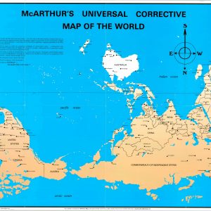
McArthur’s Universal Corrective Map of the World
$395.00 Quick View -
Sold Out
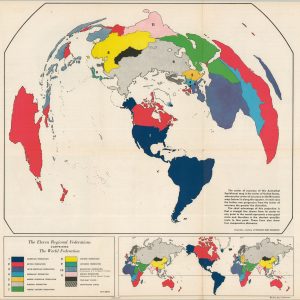
The Eleven Regional Federation Comprising the World Federation System
Quick View -
Sold Out
The Heritage of the Anglo-Saxon Race
Quick View -
Sold Out
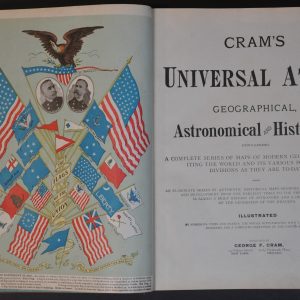
Cram’s Universal Atlas
Quick View -
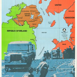
Northern Ireland The Battleground for Christians
$195.00 Quick View -
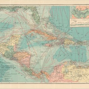
Map of Central America, Cuba, Porto Rico, and the Islands of the Caribbean Sea
$60.00 Quick View -
Sold Out
The Eleven Regional Federation Comprising the World Federation System
Quick View -
Atlante Geografico Metodico
$200.00 Quick View -
G. Freytag’s Neue Verkehrskarte von Österreich-Ungarn
$250.00 Quick View -
Nouveau Planisphère Officiel L’Empire Colonial Francais et les Possessions Coloniales des Nations
$275.00 Quick View -
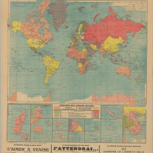
Blickin die Welt [A Look at the World]
$345.00 Quick View -
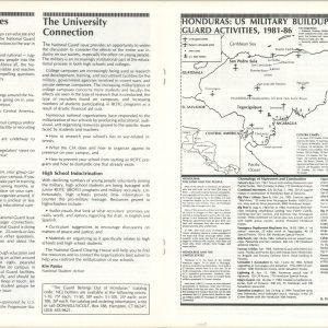
Honduras: U.S. Military Buildup and National Guard Activities, 1981 – 86.
$200.00 Quick View -
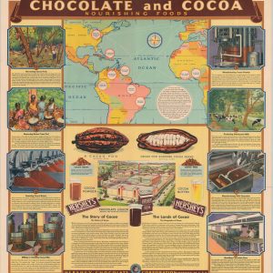
Chocolate and Cocoa Nourishing Foods
$500.00 Quick View -
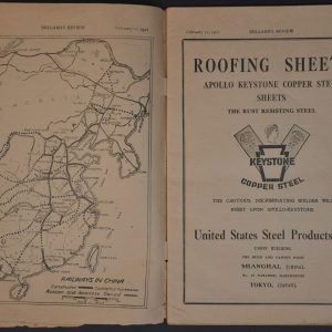
Millard’s Review of the Far East
$145.00 Quick View -
Sold Out
[America’s New Empire]
Quick View -
Singer the Universal Sewing Machine [Pan-American Exposition Souvenir]
$145.00 Quick View
![[Title Pages from Atlas Historique - Vol I]](https://curtiswrightmaps.com/wp-content/uploads/map_11.35x17.67_02-17-26_inv008340c-300x300.jpg)
![[Title Page from Atlas Novus]](https://curtiswrightmaps.com/wp-content/uploads/map_11.39x17.71_02-17-26_inv008341c-300x300.jpg)


![Blickin die Welt [A Look at the World]](https://curtiswrightmaps.com/wp-content/uploads/map_12.64x26.53_01-05-26_inv007867c-300x300.jpg)
![[America's New Empire]](https://curtiswrightmaps.com/wp-content/uploads/DSC_2451-300x300.jpg)
![Singer the Universal Sewing Machine [Pan-American Exposition Souvenir]](https://curtiswrightmaps.com/wp-content/uploads/DSC_2166-300x300.jpg)
show blocks helper