Blog

The Chicago Daily News War Book For American Soldiers, Sailors, and Marines
A 21st-century analysis of a pocket-sized volume published in 1918 by the Chicago Daily News for American soldiers preparing to fight in World War I.
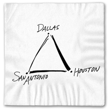
Most Mass Produced Map?
With over 140 million customers served in 2024 alone, Southwest Airline’s ‘map’ napkin is my best guess for the most mass-produced map of all time.
A Handwritten Poem – Death is such a Lonesome thing…
Death is such a lonesome thing – perhaps that is its tenor.
Remembering Dennis McClendon, aka ‘Mr. Downtown’
In memory of Dennis McClendon (1957-2024).
A Hand-Book for Overland Expeditions
A lighthearted examination of The Prairie Traveler, written by Randolph Barnes Marcy and published with the support of the United States War Department in 1859.
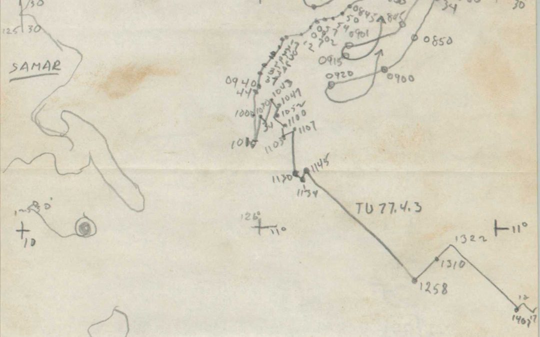
Recollections of the Battle of Surigao Straits (Samar Island)
Transcription of a previously unpublished account of the Battle off Samar from a signalman aboard the escort carrier U.S.S. Fanshaw Bay.
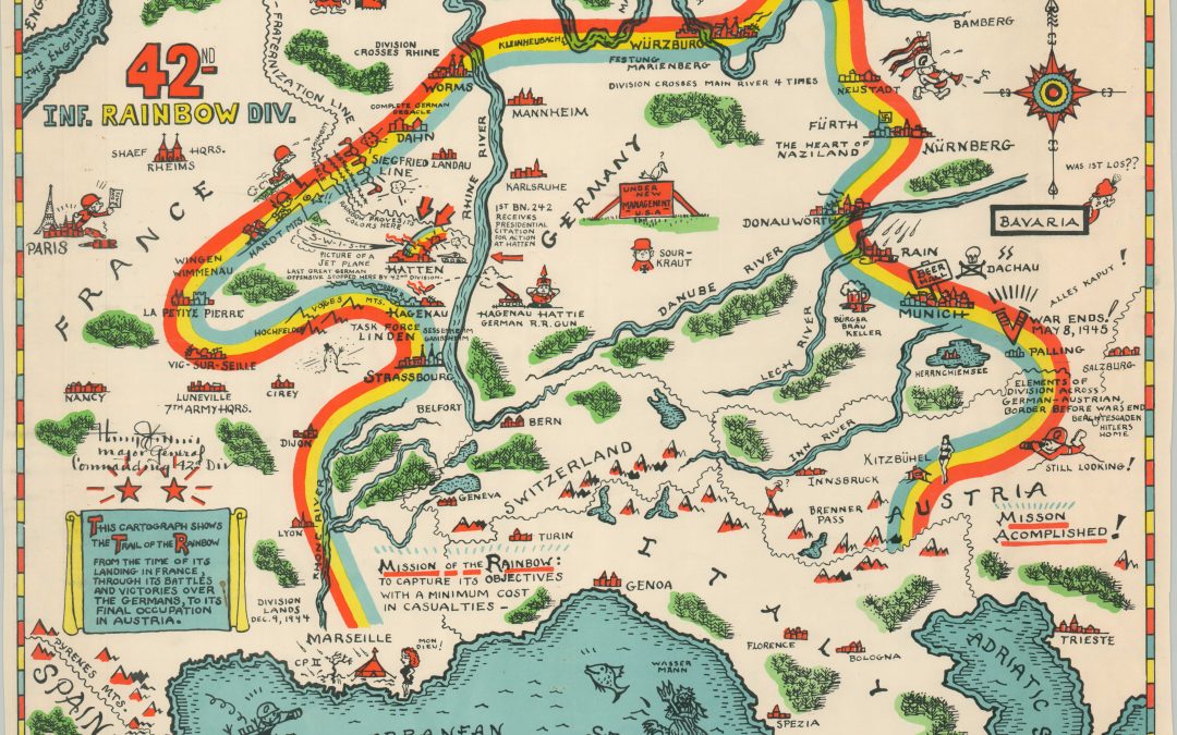
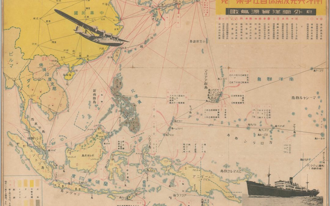
Trail of the Rainbow Division
The route of the 42nd Division across Europe during WWII is explored with this documentary and map.
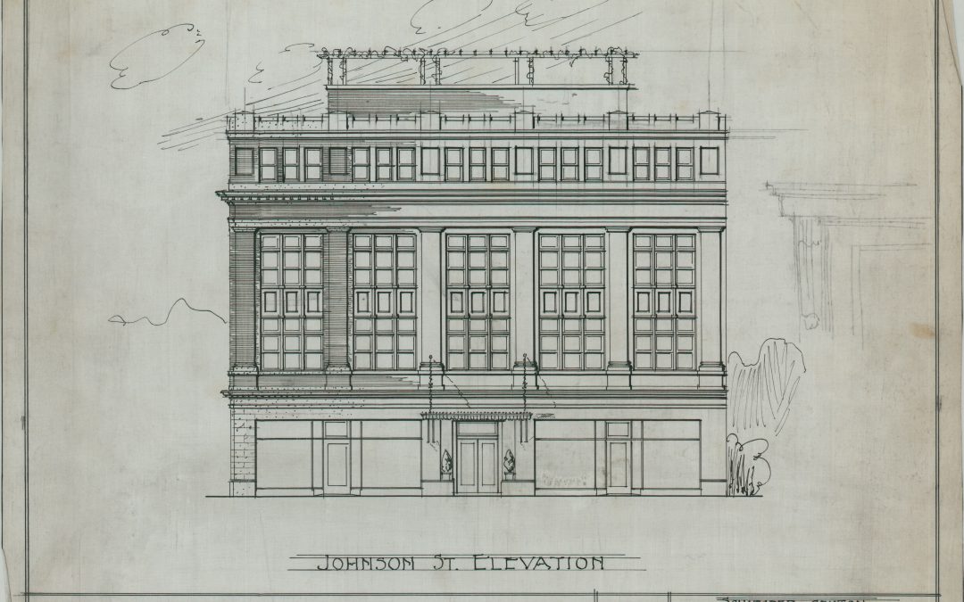
More than Maps – Architectural Diagrams of the Dane County Historical Society
An interesting project involving 20th century architectural diagrams from Wisconsin.
A Distant Branch of the Family Tree – Part I
The holiday season is a perfect time to reflect on family, especially those we miss most dearly. In early 2023, my wife lost her grandmother, a remarkable woman who lived to be 98 – she golfed a 90 on her 90th birthday! The life of Eleanor Custis Wright could take up...
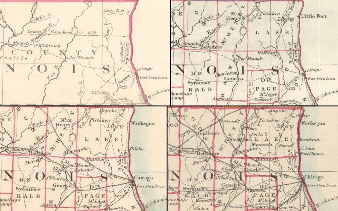
Mapping Change #2 – S.D.U.K. Maps of Lake Michigan
For the second blog of my Mapping Change series, I’m excited to explore four maps of the Upper Midwest created by the Society for the Diffusion of Useful Knowledge (S.D.U.K.) and published between 1833 and c. 1861.