
Most Mass Produced Map?
Mar 26, 2025 | Maps
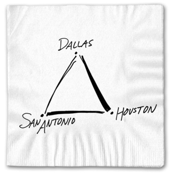
I recently had the pleasure of joining friends in the Phoenix area for some Spring Training, March Madness, and desert sunshine. En route aboard Southwest Airlines, I was considering the ‘map’ placed on my tray table in the form of a disposable napkin....Remembering Dennis McClendon, aka ‘Mr. Downtown’
Nov 13, 2024 | Maps
Dennis McClendon was an invaluable promoter of Chicago’s cartographic, historical, and online communities. He was a Texan, a Chicagoan, a mapmaker, a tour guide, a preservationist, a historian, a traveler, a cook, a handyman, an author, and much more. While he...A Hand-Book for Overland Expeditions
Sep 12, 2024 | Maps
I was recently cataloging a 19th-century travel volume described online as a ‘beginner’s guide to the Oregon Trail.’ Having spent many hours playing the PC game at the Knox County Library (usually, not very well), I was immediately intrigued. After...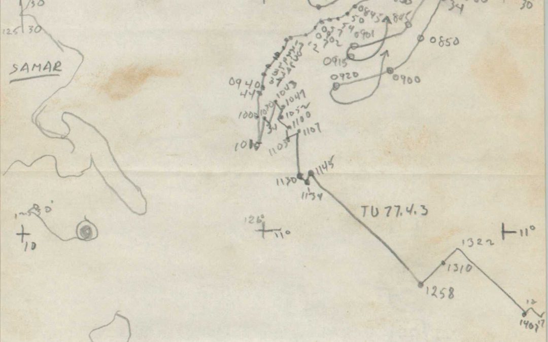
Recollections of the Battle of Surigao Straits (Samar Island)
What follows is my transcription of a first-person account of the Battle off Samar, one of the largest and bloodiest naval engagements in the broader Battle of Leyte Gulf. It has been replicated as faithfully as possible, including spelling and punctuation errors. The...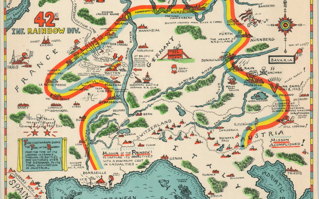
Trail of the Rainbow Division
I think it’s really our duty, with the years that we have remaining, to see that people never forget this. – Ken Carpenter (1920-2010), 232nd Infantry Regiment This gripping documentary chronicles the efforts of the 42nd Infantry ‘Rainbow’...
show blocks helper