For the second blog post of my Mapping Change series, I’m excited to explore four maps of the Upper Midwest created by the Society for the Diffusion of Useful Knowledge (S.D.U.K.) and its successors and published between 1833 and c. 1861.


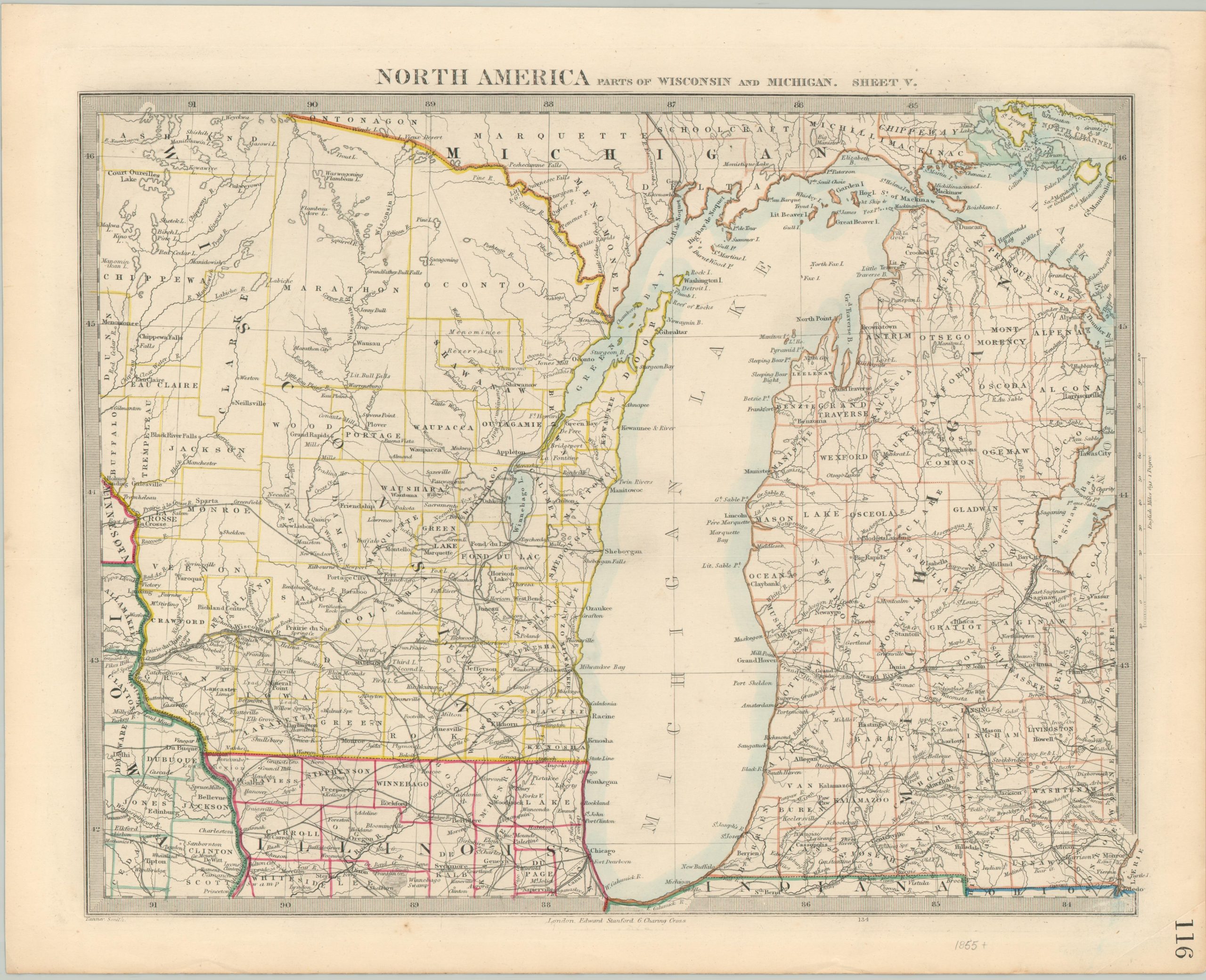
At first glance, a few obvious developments are immediately apparent. In the original engraving, the outline of Lake Michigan is oddly straightened and distorted, with subsequent versions showing a more accurate depiction. The title has also been updated after the first editions, reflecting Michigan’s statehood and Wisconsin’s impending admission into the Union – an upgrade from Huron Territory. Finally, the process of county formation is clearly shown through outline color, originally applied by hand at the time of publication.

Examining a few specific regions vividly illustrates the means by which land across the Northwest Territory was acquired, organized, and populated during the 19th century. The four excerpts above are all centered on Bois Blanc Island, at the eastern end of the Strait of Mackinaw. Tremendous improvements are made between the first (upper left) and second (upper right) editions; including updates to the outline of Grand Traverse Bay, the addition of islands to the west of the strait, and numerous interior details. The gradual process of exploration, Indian removal, and settlement is shown by new elements like towns (e.g. Mackinaw City), roads, and geographic features. The Odawa village of L’Arbre Croche has been replaced by the township of Little Traverse in the last frame. Also of interest is the abolition of Charlevoix and Wyandot counties.

These fragments show the expansive prairie around the city of Chicago in northeastern Illinois. A number of Native American villages, boundary lines, and ancient burial mounds present in the earliest image are no longer seen on the map by the fourth edition. Railroads proliferate, emanating from Chicago and connecting to the rich agricultural and mineral regions to the west. The Illinois & Michigan Canal is also visible adjacent to the portage, beginning with the third box. Towns like Aurora, Waukegan, and Napierville gradually make an appearance and would eventually coalesce into the Greater Chicago Metropolitan Area.

Here we can see how the area between Green Bay and Lake Winnebago in eastern Wisconsin developed between the early 1830s and early 1860s. Settlement in the Green Bay Township is concentrated along the course of the Fox River and on the shoreline of the lakes. Railroads were less prolific than in other parts of the region, though Green Bay, Manitowoc, and Sheboygan are all connected by the time the final map was issued. Other gradual geographical updates are reflected elsewhere on the maps.


Despite the obviously impressive efforts of the publishers to include up-to-date information, there were inevitably oversights and omissions over the maps’ lifetimes. In the views of Mackinaw mentioned earlier, the lightship identified as a navigational aid was out of commission by the time the second map was printed (c. 1844). Fort Dearborn, near Chicago, is prominently featured on all four maps, but it was almost completely destroyed by a fire in 1857. Similarly, the Chicago portage is shown, despite its outdated relevance. Antiquated and obsolete elements appear across the editions; such as the factories, Indian village, and old fort labeled in southern Michigan and compared in the two selections below (1833 and c. 1861).


In summary, the four maps provide some interesting insights into the forces by which Michigan, Wisconsin, and northern Illinois were mapped during the middle decades of the 19th century. Increased exploration and surveying, driven largely for commercial reasons, resulted in substantive advances in geographical accuracy. Transportation was an important factor for patterns of settlement, beginning with navigable rivers and canals and accelerating with the tremendous expansion of the railroad during the period covered. Unfortunately, most of this development came at the expense of local indigenous populations – the disappearance of whom is also cataloged on the maps.

All four maps covered above are available for sale on my website, and I would be happy to offer a discount if you are interested in the group. High-resolution images are also available so you can make your own comparisons. For more information on the S.D.U.K., check out my blog post here. Thanks for reading!
Sources: Pioneering the Midwest (Library of Congress); A Brief History of Michigan (PDF); Ethnic Groups in Wisconsin: Historical Background (UW-Madison); Illinois & Michigan Canal (Encylopedia of Chicago); History of Survivance: Upper Midwest 19th-Century Native American Narratives (DPLA);