People naturally gravitate to maps of places with which they have a close personal affinity. Therefore, it should come as no surprise that I’m constantly looking for maps of my hometown, despite not having lived there for well over a decade.
To my great surprise, I found what looked like the perfect map on eBay. It showed Vincennes nestled on the banks of the Wabash, and had bright color highlighting the various railroads in operation throughout the city. If you’ve ever been to Vincennes, chances are you’ve been stopped by a train, and the map vividly highlighted the close relationship between the city and the rails.
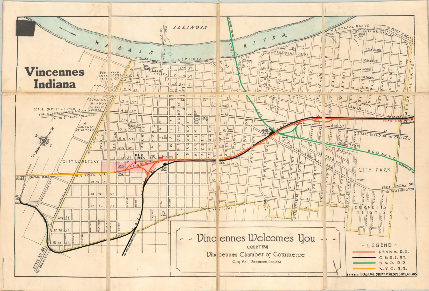
When the map arrived, I could see the colored updates were done by hand and that the map was a custom creation, in a completely different format than the map would have been originally issued. It was dissected, mounted on linen, and had a sticker indicating the “C.E. System.”
The seller had a few other similar maps in their auction, and I reached out for more information. Turns out the Vincennes map was part of a larger collection acquired from a retired engineer from the Pennsylvania Railroad, and the “C.E. System” stamped and stickered referenced the Central Engineering Department. We haggled back and forth, and I eventually purchased what remained of the set – about 70 maps in all.
The buy was impulsive. The covered cities were an eclectic mix of large and small towns throughout the Midwest and Northeast, and I had little idea of the role the Pennsylvania Railroad played in the larger transportation history of the United States. But these maps were used – created for a purpose and updated with time. Most maps are static images, capturing one moment in two dimensions, but these were living, working documents that were too interesting to pass up.


So, what are they? As far as I can tell, each of the maps was a custom creation of the railroad engineers. The vast majority were based on readily available commercial publications published in the late 1920’s or mid-1930’s. All were issued at a scale of 1” to between 500’ and 1200’ (this large scale allows for the transmission of granular details that were essential to the railroad operations) and photostatically replicated.
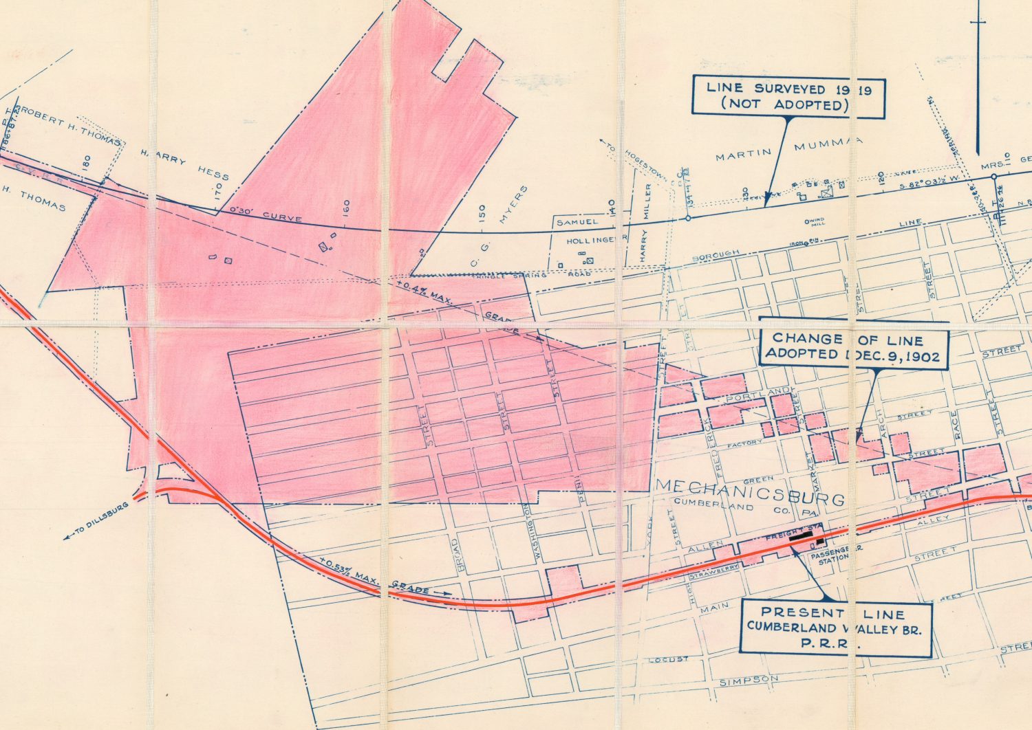
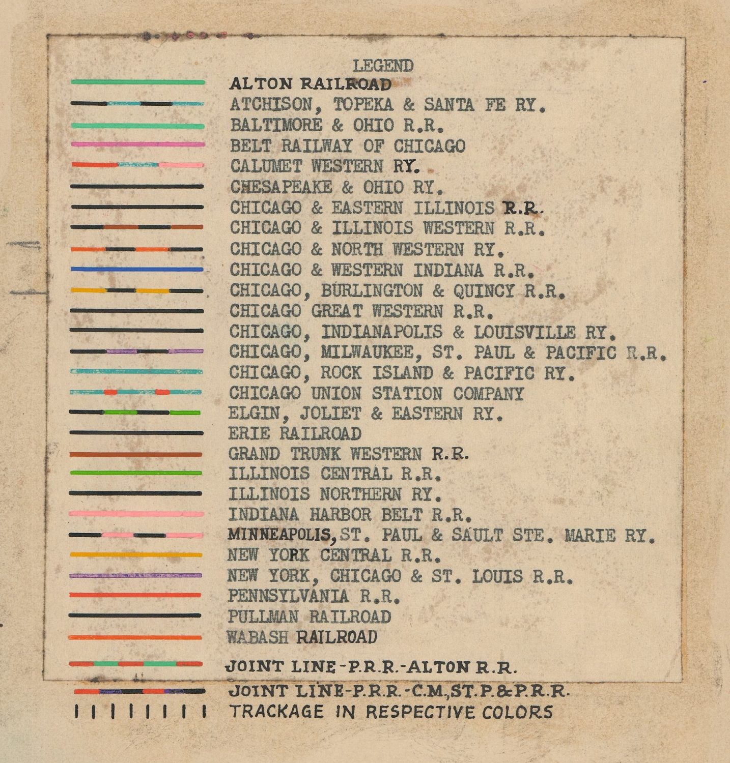
Updates were often made to the image prior to replication, including the addition of details like passenger stations, route branch names, and the locations of connecting destinations. Custom legends are also added in most circumstances to identify the primary railroad operators. Once the updates were made, the map was then copied, printed, dissected and mounted on linen – presumably for preservation and convenient storage.
After the map was complete, engineers would then update it by hand in bright colors to identify the property owned by the Pennsylvania, and track ownership of local competitors. Additional manuscript notes identifying relevant details like train yards, depots, stations, etc. are also prevalent throughout the set. Further hand-applied custom updates are present throughout the set in the form of paste-downs, especially when track ownership changed significantly in a particular place. A few maps have penciled in notes detailing specifics on real estate transfers, joint trackage, abandoned lines, etc. Updates are dated to the early 1950’s, meaning these maps each reflect about a decade of evolutionary change of the Pennsylvania Railroad.

The Pennsy got its start in 1846, when the Pennsylvania legislature approved the construction of a rail line between Harrisburg and Pittsburgh to compete directly with the success of the Erie Canal, which opened in 1825 and diverted much of the west bound freight traffic away from Philadelphia. Work began the following year under surveyor J. Edgar Thompson and was completed by 1854.

Profits came quickly, and by the end of the first year the stockholders of the Pennsylvania Railroad were paid a dividend, which would continue without interruption until 1946. Company earnings were quickly reinvested, and throughout the 1850’s and subsequent decades the Pennsylvania Railroad acquired the Main Line of Public Works, numerous independent railroad companies, two canals, and hundreds of miles of trackage rights on competing routes. Subsidiary companies were formed for intermodal freight transportation, locomotive construction, the supply of raw materials, and more.
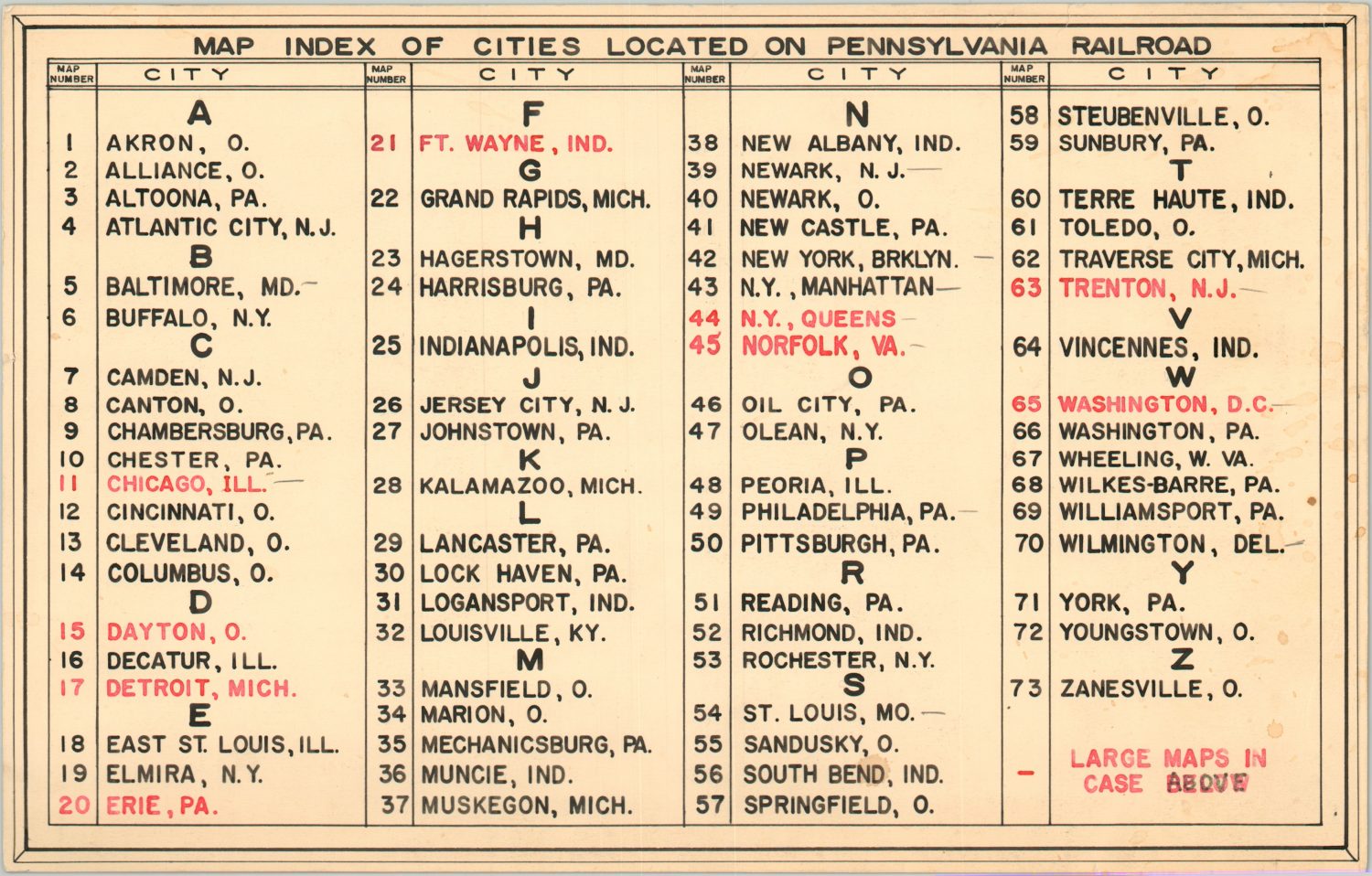
One of the primary commodities hauled along the lines of the Pennsylvania Railroad was coal. Numerous branches were constructed to serve collieries throughout the Appalachians, and the set of maps included six separate sheets covering coal mining operations and geological deposits.

Growth continued relatively unabated, and by the early 20th century the Pennsylvania Railroad network stretched over 10,000 miles and was one of the largest public corporations in the world. At the end of World War I, the Pennsy was carrying more traffic than any other railroad in the United States, with the New York Central as its next closest competitor and biggest rival.
But the good fortunes would not last, and while WWII provided a boon to railroad companies across the United States, the development of the National Highway System and increasing ubiquity of the automobile hurt both passenger and freight traffic. 1946 was the first year the Pennsylvania Railroad lost money, and it was unable to ever fully bounce back. But its competitors were also feeling the strain, and a merger with the hated New York Central in 1968 saw the creation of the short-lived Penn Central.

Serious financial difficulties persisted, and the Penn Central filed for bankruptcy just two years later in 1970. The National Railroad Passenger Corporation (Amtrak) was organized in 1971 to take over operation of many of the failing passenger routes from companies across the United States, and assumed operation of many of the former lines of the Pennsylvania Railroad. The Consolidated Rail Corporation (Conrail) was organized in 1976 to run the operations of several bankrupt companies, including many of Pennsy’s former freight lines. Conrail was split between CSX and Norfolk Southern in 1999, and trains from both successor organizations continue to operate to this day.

The impact of the Pennsylvania Railroad on transportation and commerce across the United States during its 120+ years of operation was tremendous, and will continue to affect how people and things are moved from place to place for the foreseeable future. These maps offer a unique window into the operations of the railroad behemoth in its twilight years, when decades of unprecedented success prevented meaningful changes that may have saved the line, or at least postponed its demise.
You can check out the entire collection of Pennsylvania Railroad maps available for sale here. Feel free to drop me a line if you have any questions, and thanks very much for reading!