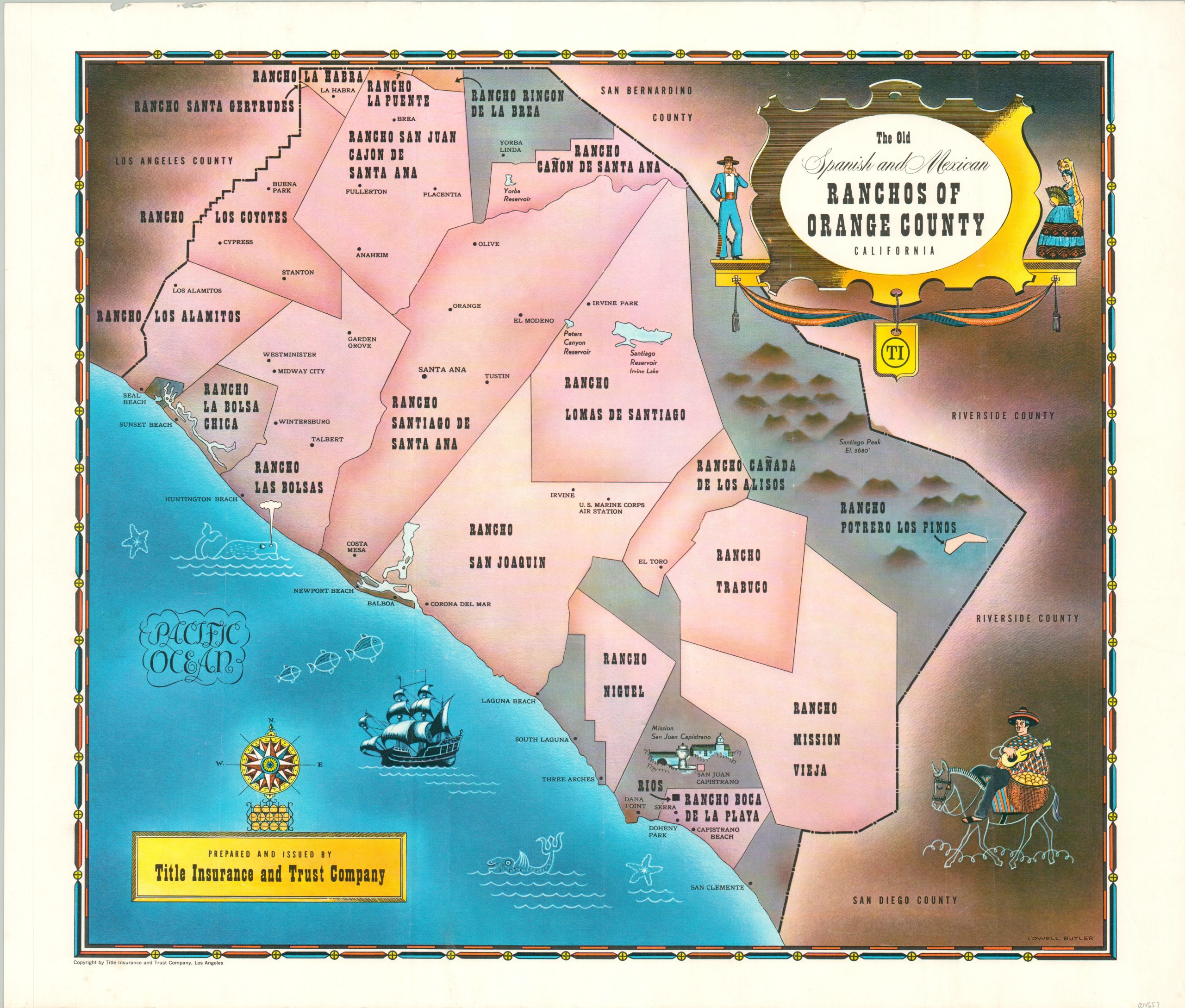
The Old Spanish and Mexican Ranchos of Orange County California
Mid-20th century promotional pictorial for Southern California
Out of stock
Description
This interesting map of southern California highlights the historic organization of Orange County into Mexican ranchos. Modern cities ranging from La Habra to San Clemente are labeled amid borders that were approximately a century old at the time of publication. Scattered geographic features are also identified. Pictorial elements include several vignettes, a decorative title cartouche, and compass rose.
The map was illustrated by Lowell Butler and published by the Title Insurance and Trust Company in Los Angeles in 1955. The map was likely distributed as a promotional item to prospective clients, encouraging them to invest in a region steeped in history.
Source: Ranchos in California.
Map Details
Publication Date: 1955
Author: Lowell Butler
Sheet Width (in): 20.5
Sheet Height (in): 17.5
Condition: A-
Condition Description: Light wear along the outer edges of the sheet, including a few small tears in the upper left. Fain creasing where previously rolled. Very good overall.
Out of stock

