The Official State Atlas of Kansas
Original price was: $4,000.00.$3,000.00Current price is: $3,000.00.
One of the finest efforts to map Kansas during the 19th century.
1 in stock


Description
“The average Kansan understands the marvelous development of his State during the last ten years, but to the uninitiated, seeing is believing. Therefore it was decided to present to the incredulous actual delineations of manufacturing and industrial interests; public buildings; educational institutions; parks, ranches, farm properties and improvements; groups of fine-bred and imported stock, of which every variety will be found to exist within the borders of the State; loan and banking institutions; opera houses, hotels and residences, which in style of architecture compare not unfavorably with those of older and more pretentious States.” – Preface.
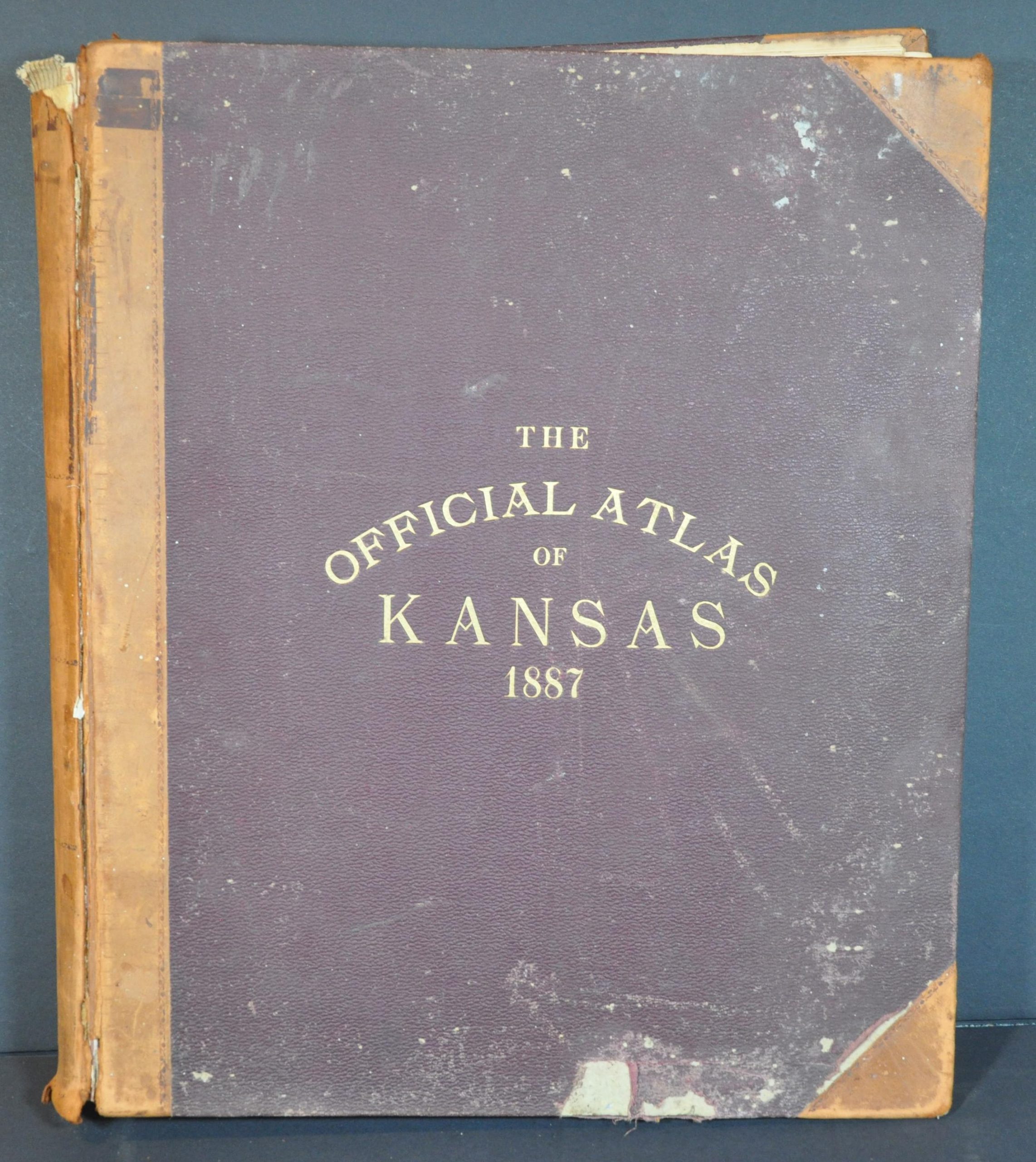
This massive state atlas, one of the largest of its kind issued, was published in Philadelphia by L.H. Everts & Co. in 1887. “Compiled from Government Surveys, County Records, and Personal Investigations” (according to the title page), the scarce volume offers an incredible amount of information on The Sunflower State during the late 19th century.
The folding map in the front is one of the finest of Kansas printed during the time, highlighting the critical importance of railroads in distributing people and goods across the state. Over 330 pages of maps (nearly 900), descriptive text, and illustrated views follow; offering an unprecedented look into the state’s geographic, economic, and industrial composition during a period of tremendous growth.
Of particular interest are the ‘Exodusters’, former slaves who fled the South after Reconstruction and settled in large numbers across Kansas. The all-Black town of Nicodemus, the oldest and only such community still in existence west of the Mississippi, was founded in 1877 and can be seen on page 236.
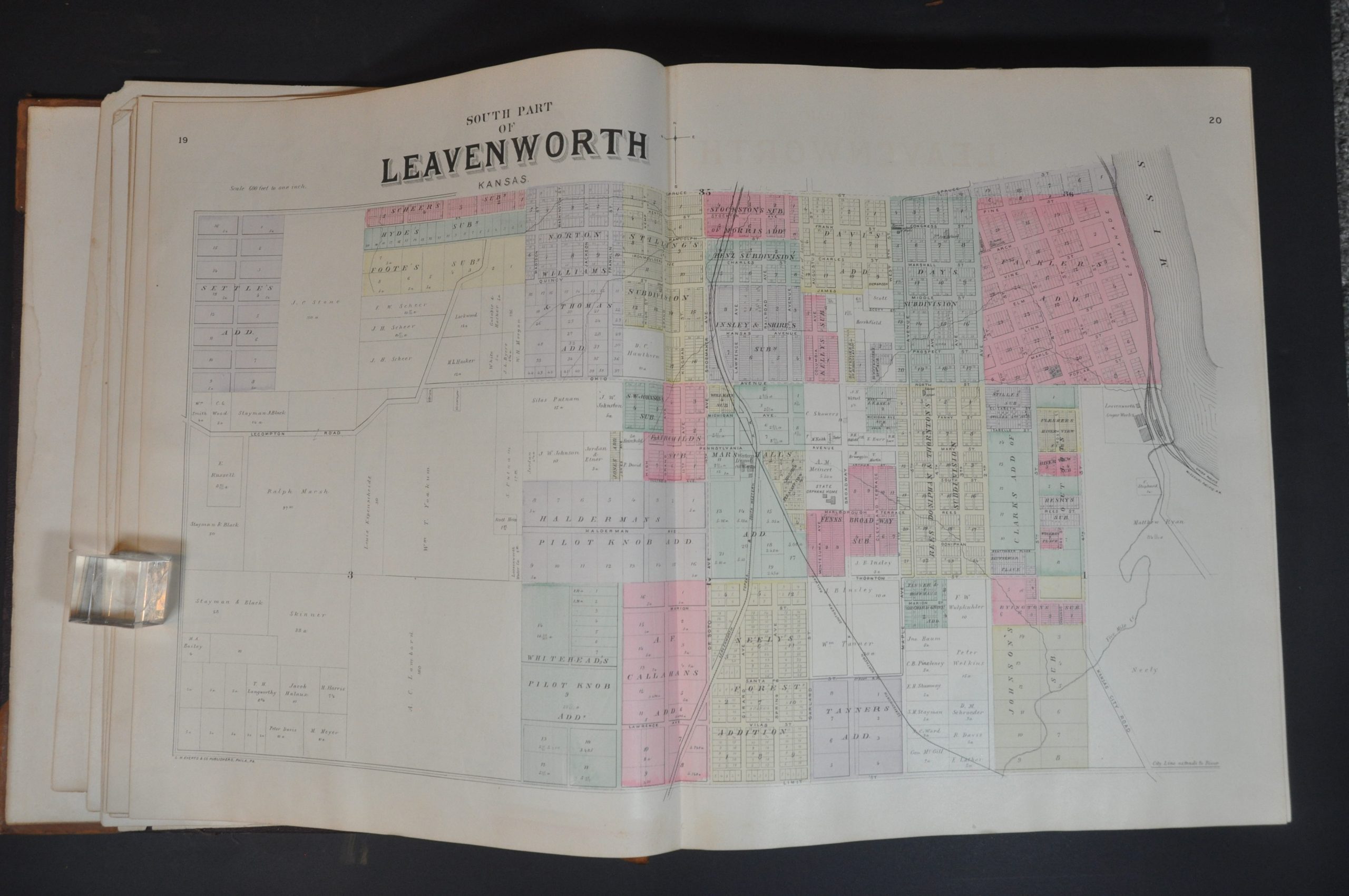
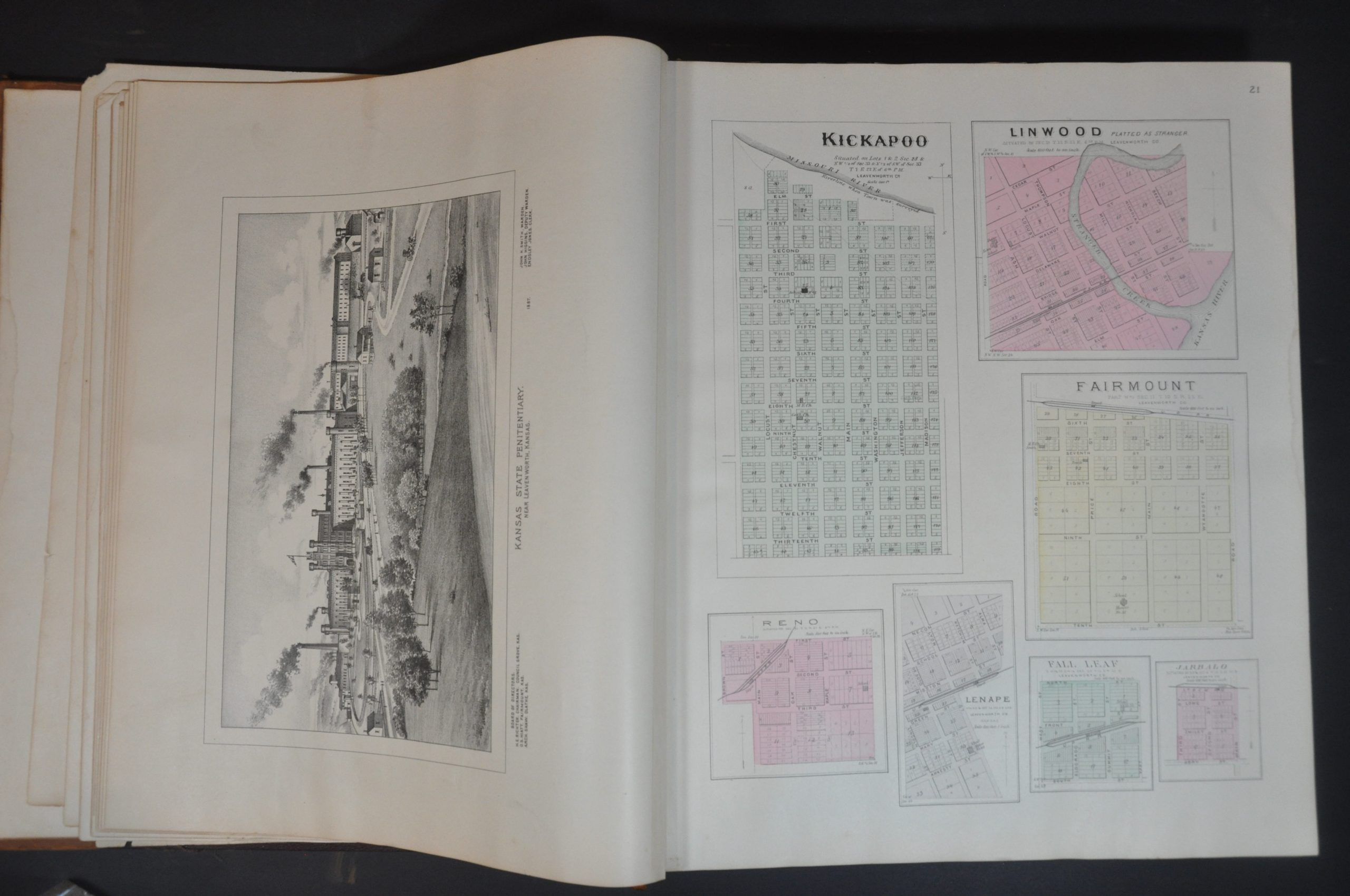
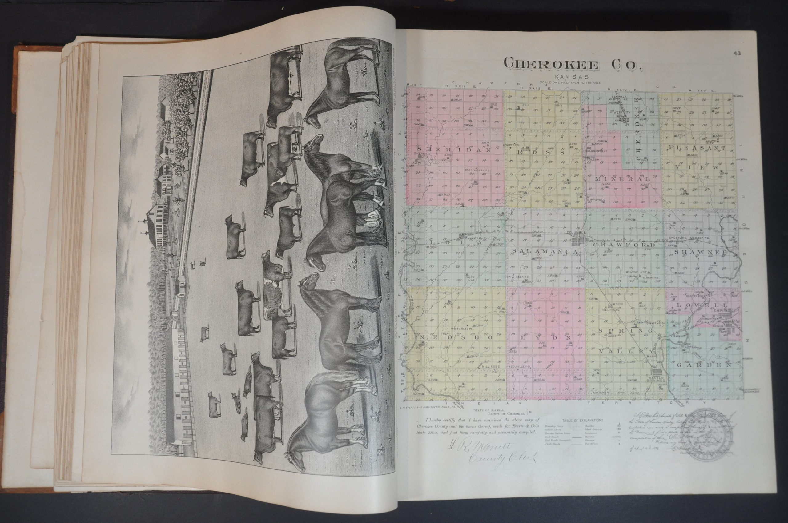
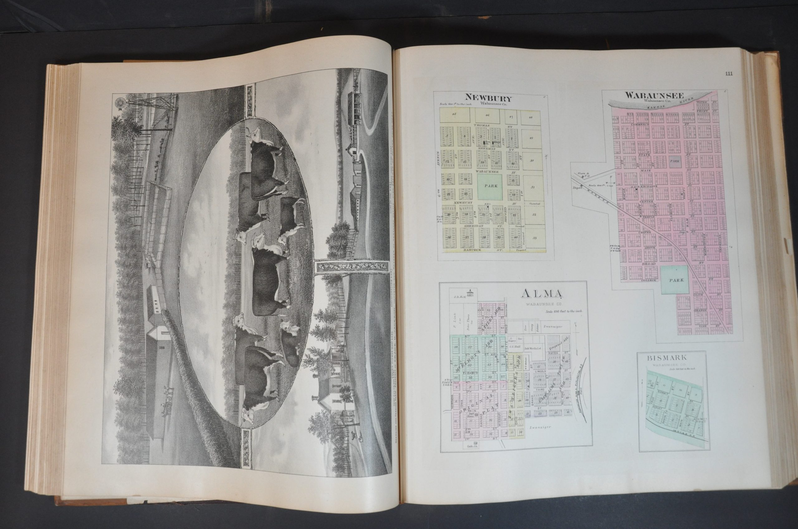
Plat maps of villages, cities, townships, and counties identify a wealth of contemporary information. The names of local landowners, locations of schools, post offices, churches and other important buildings, transportation and infrastructure systems, prominent landmarks, and geographic features are finely outlined and labeled.
Several of the city plans are printed on thin paper and fold-out, allowing for larger scales like 600 ft. to the inch. Other communities are represented by bird’s eye views, with empty lots ready to embrace newcomers and the railroad snaking into the horizon or foreground.
Such an elaborate publication would have been tremendously time-consuming and costly to produce. According to the preface, it required a large team over two years to complete and necessitated numerous updates throughout the process. In order to defray these costs, the atlas was sold on a pre-order subscription basis.
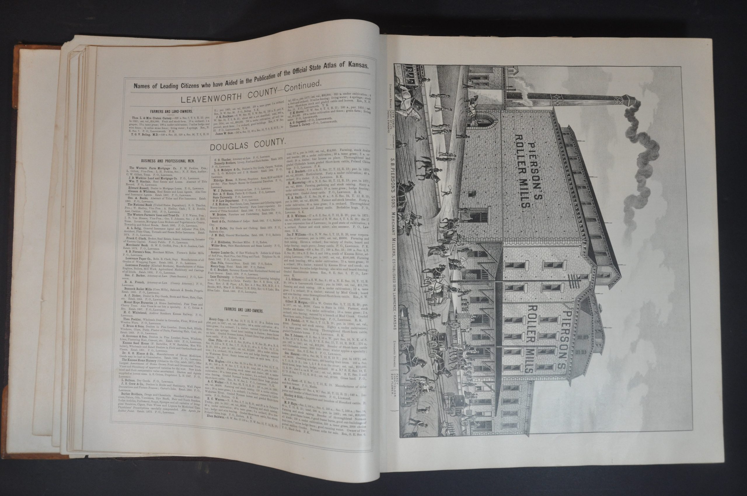
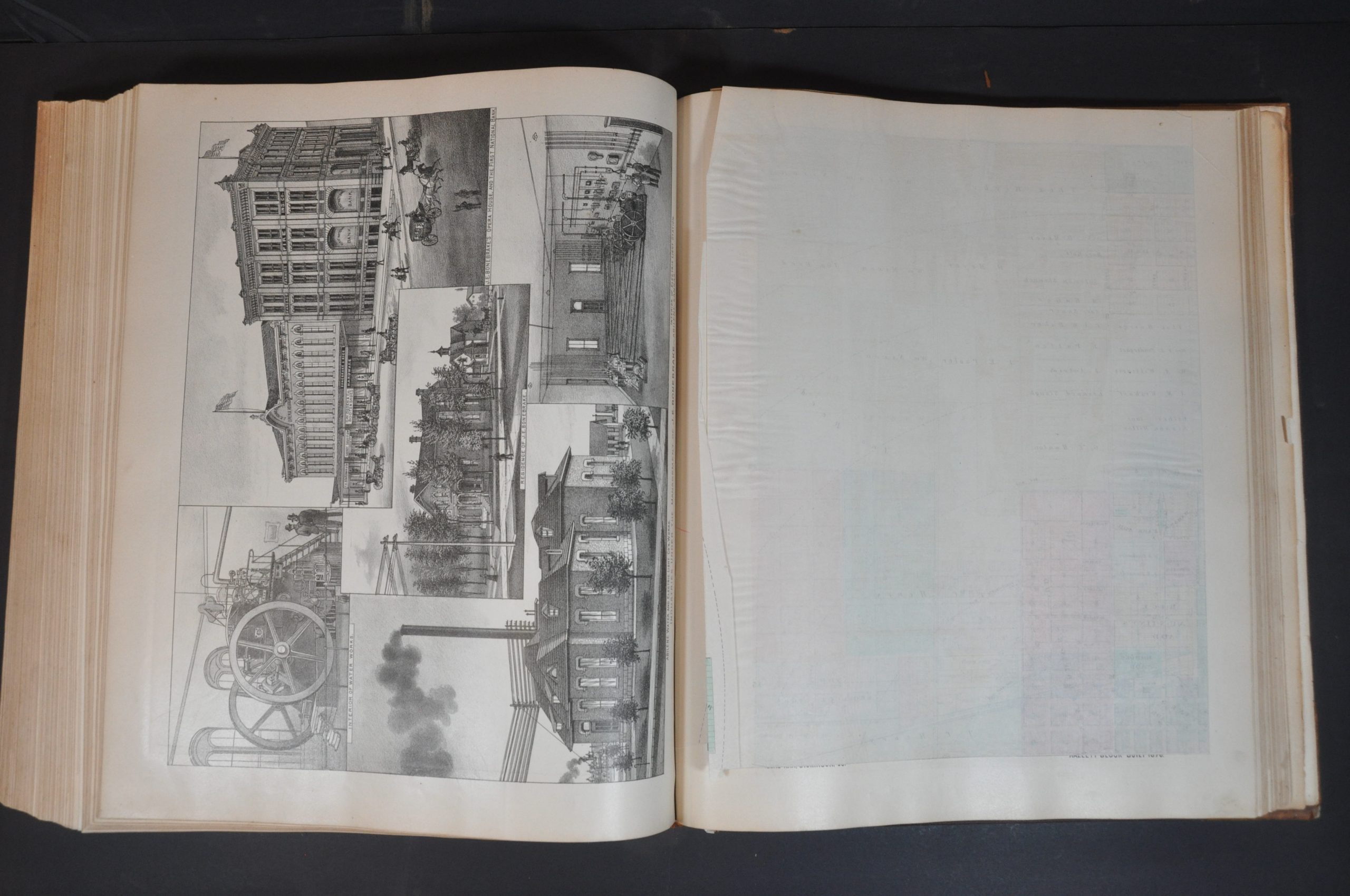
Furthermore, residents and companies could pay an extra fee to include a portrait, advertisement, or illustrated view of a home or business. Scores of such examples can be seen throughout, ranging from modest farmsteads to lavish homes and complex industrial parks. Other scenes capture prominent institutions like the El Dorado University, a view of Main Street in McPherson, and Topeka’s Grand Opera House. Prized farm stock – cows, hogs, and horses – are also proudly memorialized.
Map Details
Publication Date: 1887
Author: L.H. Everts & Co.
Sheet Width (in): 14.75
Sheet Height (in): 17.5
Condition: B+
Condition Description: Original quarter leather with red cloth covers with gilt embossed title block. Boards are separated (title page remains affixed to the front) and in rough shape, with heavy wear and scuffing. The preface and table of contents are creased and moderately soiled, but the rest of the contents are generally quite good. Complete - 340 pp. The large folding map in front is creased and shows heavy toning and wear in the upper right margin, away from the image. Scattered soiling, some minor offsetting, and edge wear throughout. A few of the folding maps have extraneous creasing and wrinkling. Two pages near the end are bound out of order and upside down, and show large tears - possibly when the frustrated binder tried to correct his mistake?
Original price was: $4,000.00.$3,000.00Current price is: $3,000.00.
1 in stock