The Hawaiian Islands
$75.00
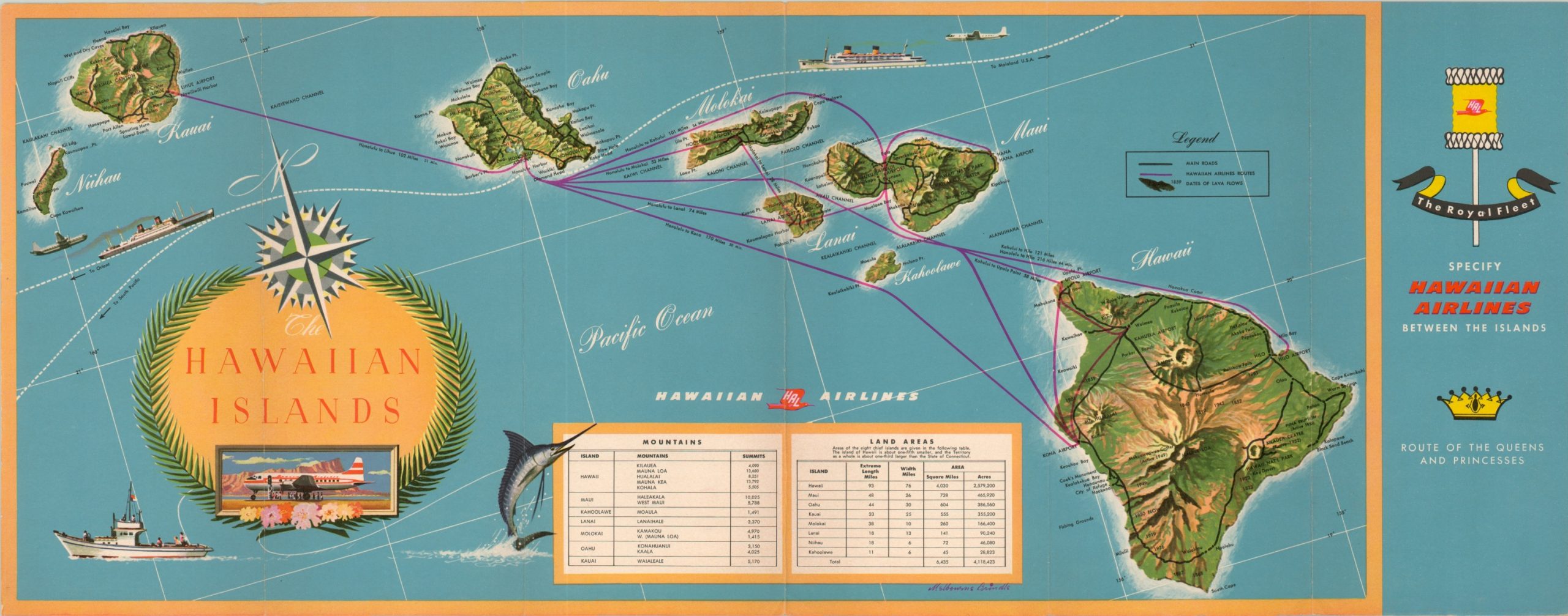
Map of the Hawaiian Islands published shortly after statehood.
1 in stock
Description
This attractive map was drawn by Melbourne Brindle and was issued in a folding promotional pamphlet published by Hawaiian Airlines in 1960, the year after Hawaii was admitted as a state. It shows all eight primary islands; Niihau, Kauai, Oahu, Maui, Molokai, Lanai, Kahoolawe and the Big Island of Hawaii and the roads available on each. Lava flows are also darkened and dated.
The routes served by the company can be seen in red, giving the reader the impression of the only connection option between certain islands. A table in the lower center outlines the land areas and mountains on each island, while text on the verso provides further information.
Map Details
Publication Date: 1960
Author: Melbourne Brindle
Sheet Width (in): 20.75
Sheet Height (in): 9.25
Condition: A
Condition Description: Light creasing and faint wear along originally issued fold lines and the outer edge of the sheet. Very good to near fine overall.
$75.00
1 in stock

