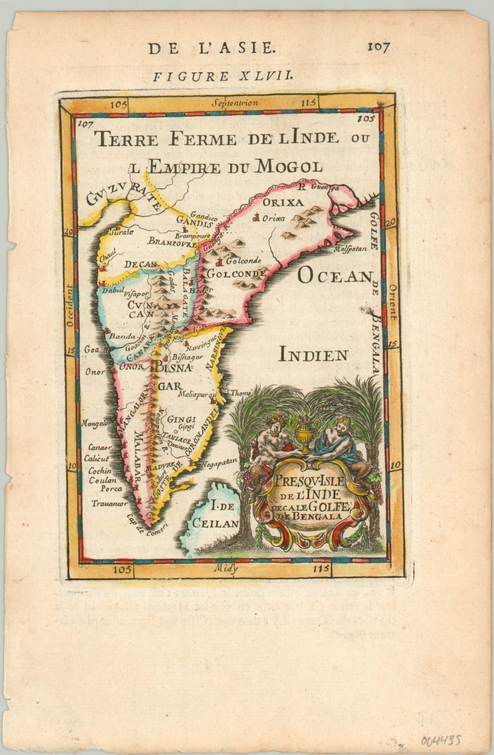
Terre Ferme de L’Inde ou L’Empire du Mogol
$125.00
The Indian subcontinent in the late 17th century.
1 in stock
Description
This charming little map shows the Indian subcontinent between the Gulf of Khambat in the east and the Ganges Delta in the west and includes a portion of the northern tip of Sri Lanka (Ceylon). It was originally published in 1683 in Paris as part of Alain Manesson Mallet’s monumental Description de l’ Univers – one of the most influential works of the 17th century. This particular example was likely issued in a somewhat later edition.
Topography is depicted pictorially and shows a large mountain range running down the center of the region – possibly the Western Ghats. Numerous settlements are labeled. Though much of the region was under the authority of the Mughal Empire until the mid-18th century, European powers like the Dutch, Portuguese, and British had obtained territorial claims along the coast by the time of publication. A decorative cartouche in the lower right shows two satyrs holding an elaborate urn.
Generally, these mythical creatures were associated with debauchery and obscenity and their inclusion might be a subtle criticism of ‘oriental’ luxury. However, contemporary 17th-century scholars (like Mallet) were also fascinated by the mysterious taxonomy of primates, though it was known they came from India and Africa. Synthesizing concepts from classical antiquity with more modern scientific observations was a key component of the Enlightenment period, and the cartouche may be an excellent example of how the satyr was re-cast in this new age.
Map Details
Publication Date: c. 1700
Author: Alain Manesson Mallet
Sheet Width (in): 5.5
Sheet Height (in): 8.25
Condition: A-
Condition Description: Light wear and faint discoloration visible in the margins, consistent with age. Modern hand color. Very good overall.
$125.00
1 in stock

