Survey for Bridge Across the Eastern Branch of the Potomac River (Anacostia River)
$150.00
Improving access to America’s capital in the late 19th century.
1 in stock


Description
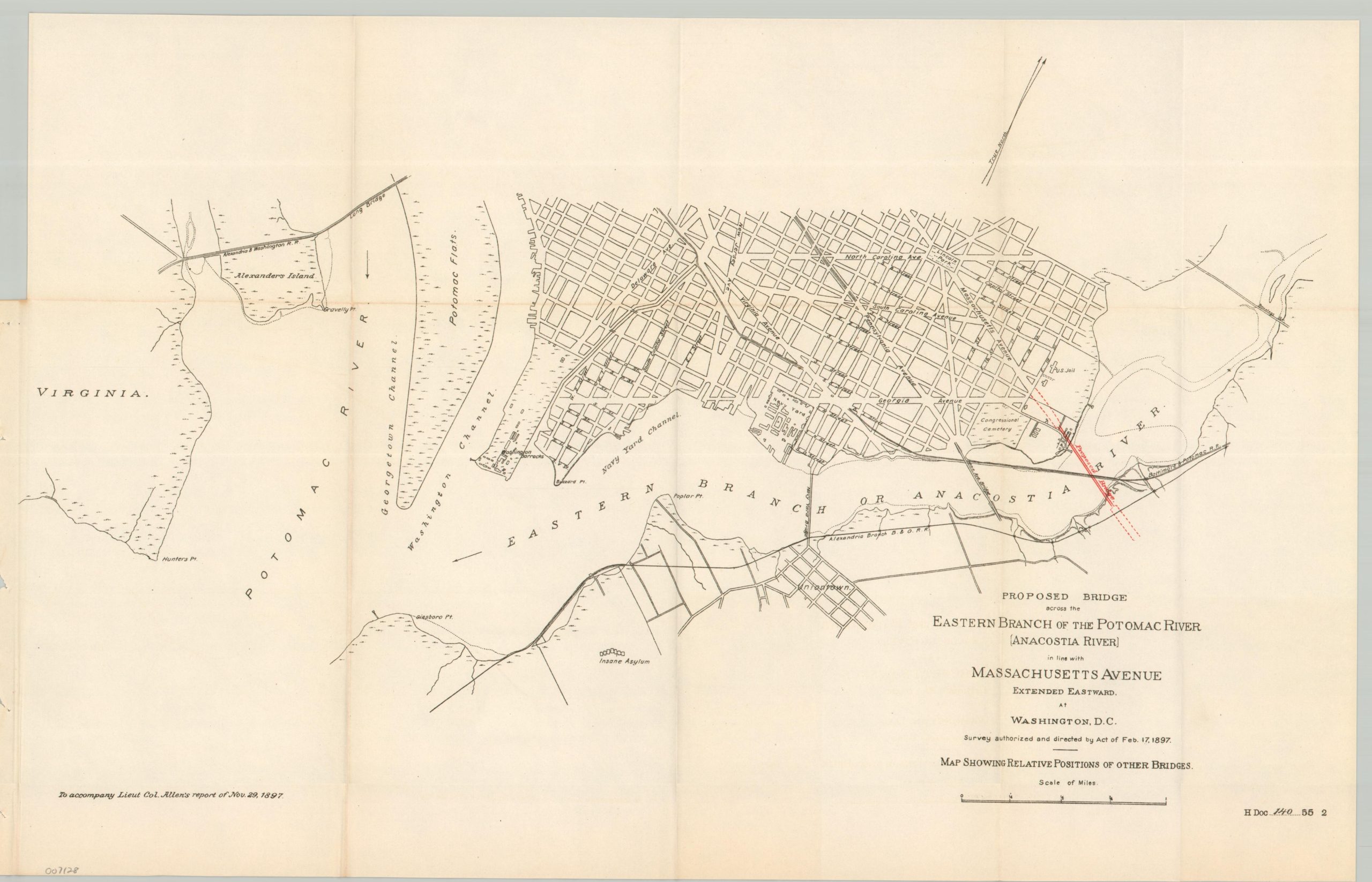
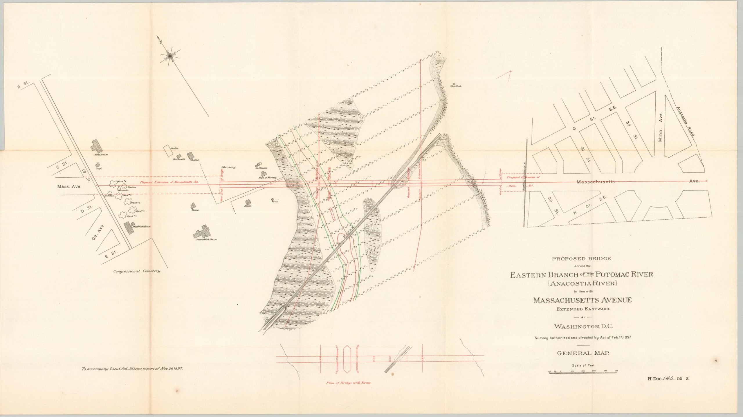
This uncommon government report was compiled by U.S. Army Engineer Charles Allen and published in 1897 by the Government Printing Office in Washington, D.C. It outlines a survey and cost estimate for a proposed bridge to be constructed across the Anacostia River in order to connect Massachusetts Avenue to the opposite bank.
Three folding sheets present various details about the project, including a cross-section of the bridge, a map of the area, and a large-scale plan of the crossing. The bridge was never ultimately constructed, possibly due to potential conflicts with the tracks of the Baltimore and Potomac Railroad that ran underneath.
Map Details
Publication Date: 1897
Author: Charles J. Allen
Sheet Width (in): See Description
Sheet Height (in): See Description
Condition: A-
Condition Description: Three folding sheets and nine pages of printed text extracted from a broken Congressional volume. A ragged binding edge and light toning along the outer edges of the sheet. Very good condition overall.
$150.00
1 in stock