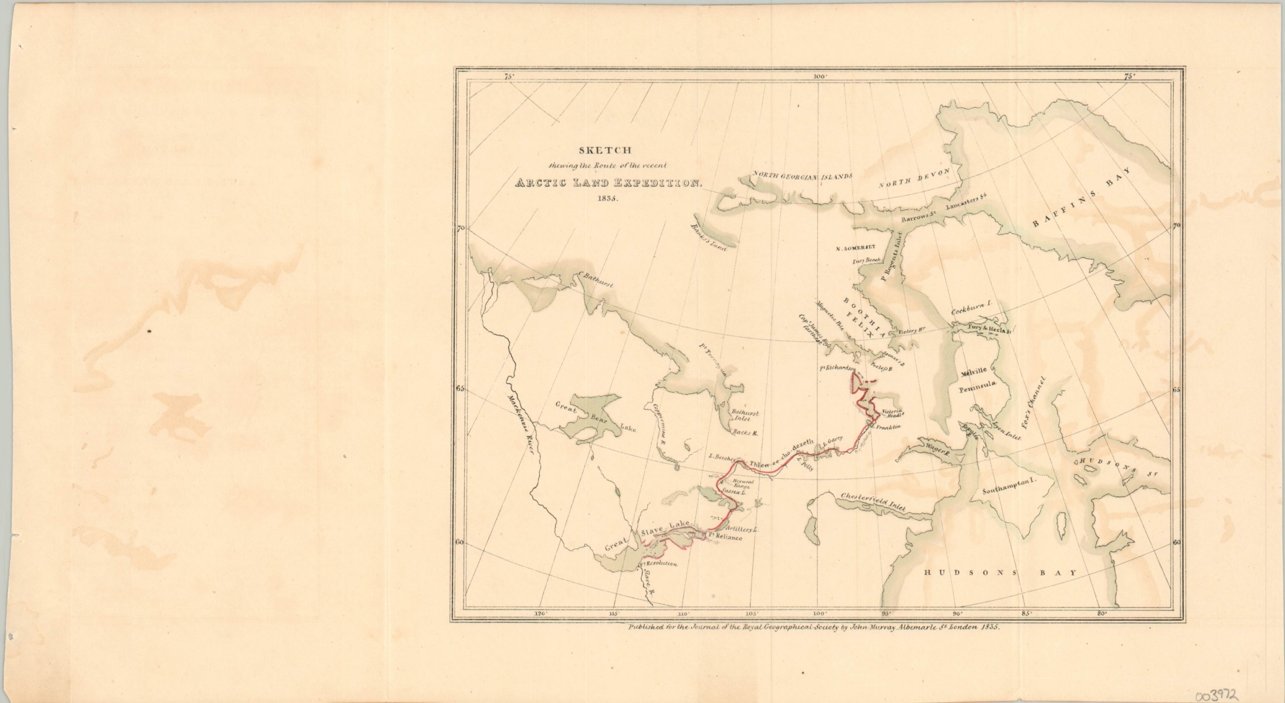
Sketch Shewing the Route of the Recent Arctic Land Expedition
$80.00
Uncommon map of George Back’s first rescue mission into the Arctic.
1 in stock
Description
In 1829, Sir John Ross led the second of his incredible expeditions into the unknown Arctic wastes of British Canada. His ship was eventually caught in the ice, forcing his crew to spend over two years in the frozen landscape awaiting rescue. One such mission was led by Sir George Back in 1833, though by the time he departed Fort Reliance on the shore of the Great Slave Lake, he received word that Ross was successfully recovered by an English whaler.
The rescue missions’ goals turned to that of discovery, and Back was the first European to discover the river named for him. The route of the group is boldly highlighted in red amidst a region of speculative cartography with ill-defined outlines and fictitious outlets into the fabled Northwest Passage.
The map was published for the Journal of the Royal Geographical Society by John Murray in London in 1835.
Map Details
Publication Date: 1835
Author: John Murray
Sheet Width (in): 15
Sheet Height (in): 8.25
Condition: A-
Condition Description: Moderate offsetting throughout and light creasing along originally issued fold lines. Very good overall.
$80.00
1 in stock

