Richfield World-Wide News Map
$65.00
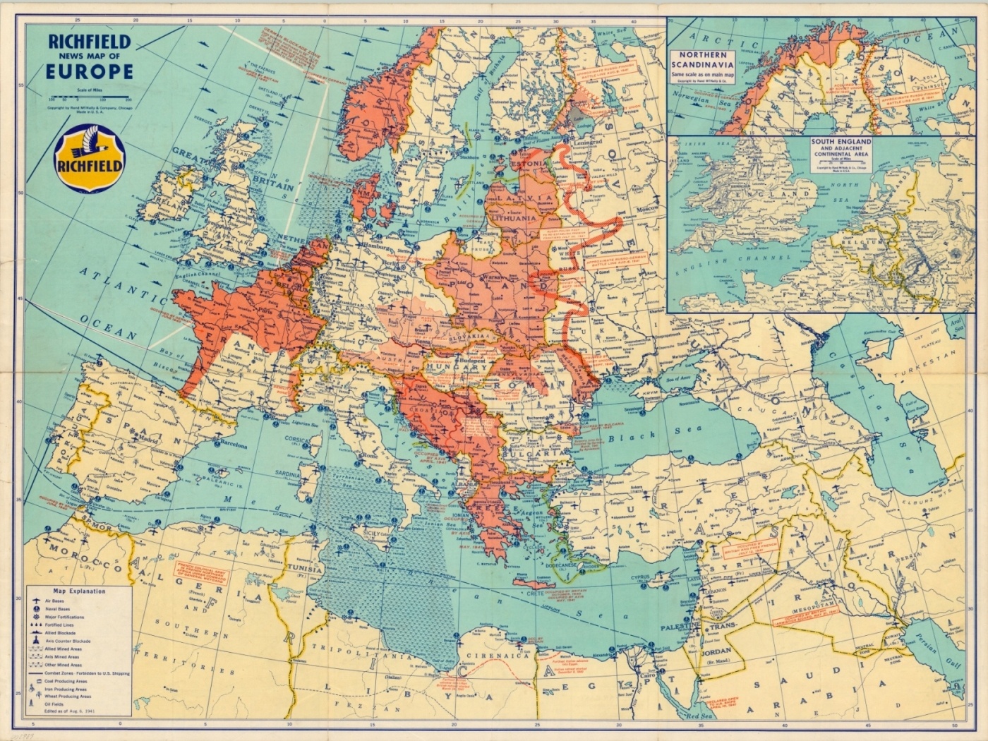
The European Theater in mid-1941, prior to U.S. involvement in WWII.
1 in stock
Description
This map shows a fascinating world situation as of August 6, 1941 – a mere five months and one day before the surprise attack on Pearl Harbor. The main image provides a detailed strategic overview of the European Theater; locating major military installations, mined areas, blockading squadrons and industrial production centers of coal, iron, wheat and oil. Text annotations optimistically highlight contemporary events, such as the occupation of Iraq and Free French resistance in North Africa.
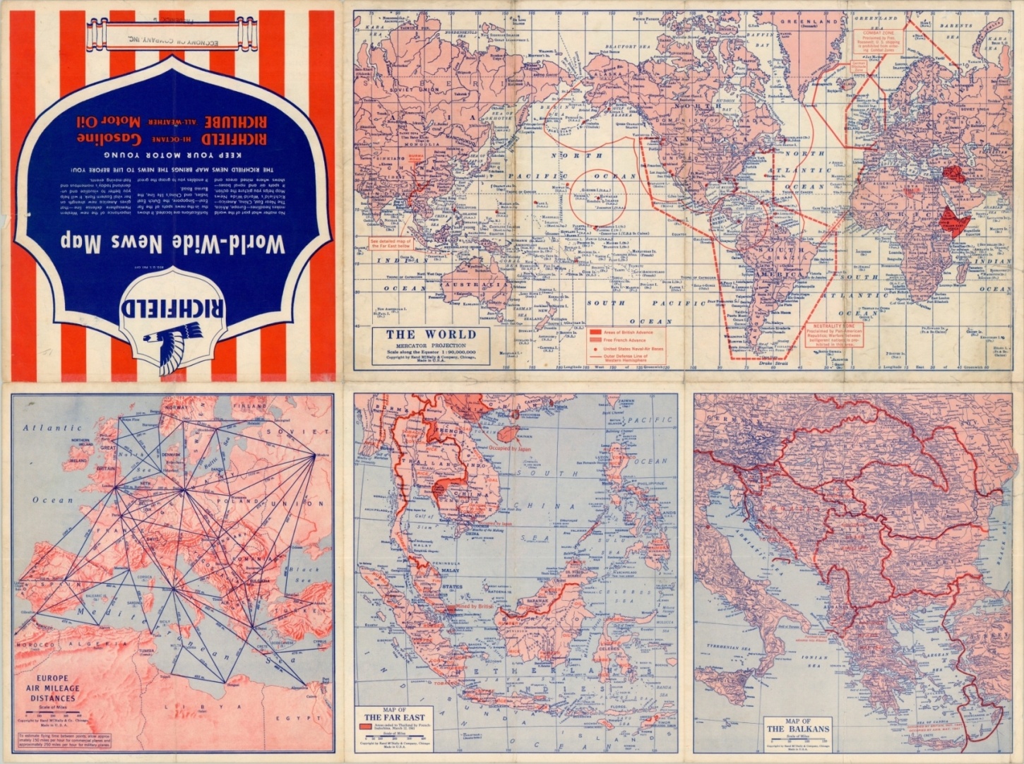
The verso of the sheet shows four smaller maps; Europe Air Mileage Distances, Map of the Far East, Map of the Balkans, and The World on Mercator’s Projection. This last has a bold red hash mark encircling the Western Hemisphere representing the alleged Neutrality Zone proclaimed by “the Pan-American Republics.”
Map Details
Publication Date: 1941
Author: Rand McNally
Sheet Width (in): 27.75
Sheet Height (in): 20.60
Condition: B+
Condition Description: There are a number of significant tears along fold lines that have been repaired and reinforced with archival tape. The image is complete and printed on a clean sheet. Good condition overall.
$65.00
1 in stock


