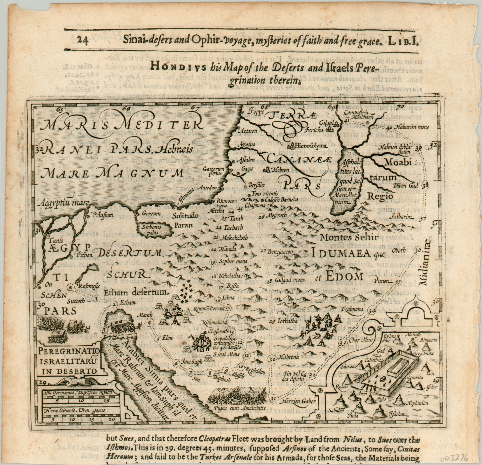
Peregrinatio Israelitaru in Deserto
$150.00
The wandering of the Israelites, included in Purchas’ Hakluytus Posthumus.
1 in stock
Description
This captivating early 17th-century map of Egypt and the Holy Land presents a historical overview of Canaan during the forty-year wandering of the Israelites. Major events like the flight from Egypt, parting of the Red Sea, and delivery of manna and quail are illustrated with small vignettes, while an inset in the lower right shows the twelve tribes situated around the tabernacle.
A strapwork cartouche contains the distance scale and a subheading attributes the map to (Jocodus) Hondius. The map was first created by Hondius in 1607 for his Atlas Minor, but this particular example was republished in 1625 by Samuel Purchas as part of his Hakluytus Posthumus.
The name of the four-volume series refers to British geographer Richard Hakluyt and was intended to be a continuation of his monumental works on travel and geography. The encyclopedic efforts bankrupted Purchas, and he died in debtor’s prison the year after it was first printed.
Map Details
Publication Date: 1625
Author: Jocodus Hondius
Sheet Width (in): 8.20
Sheet Height (in): 8
Condition: B
Condition Description: The lower half of the sheet has been trimmed, leaving portions of text below the image. Wear and toning around the outer edge, including a small chip in the upper left and light darkening from the impression of the plate on the left edge.
$150.00
1 in stock

