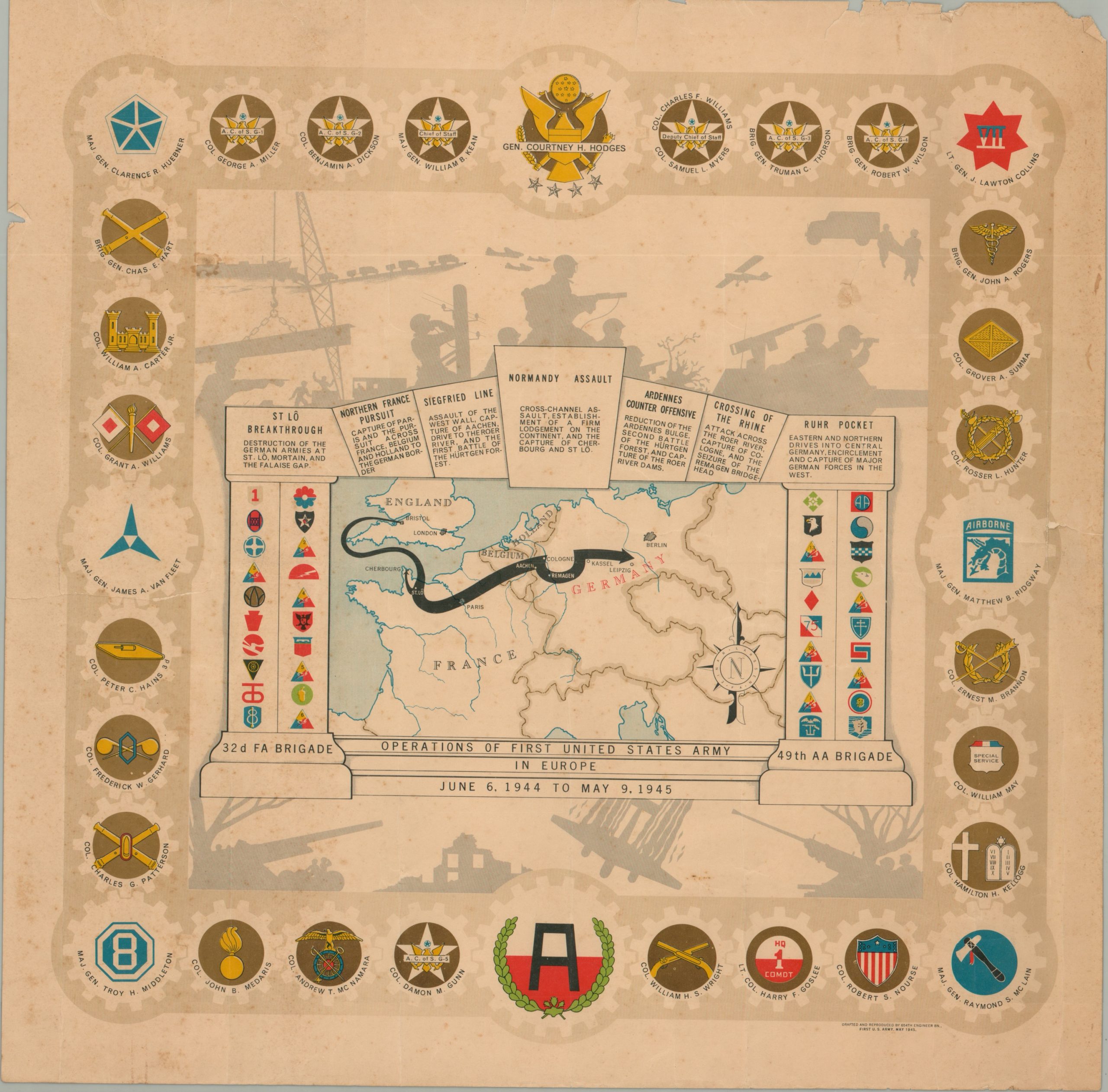
Operations of the First United States Army in Europe June 6, 1944 to May 9, 1945
$200.00
WWII campaign map of the First United States Army.
1 in stock
Description
Although First Army Headquarters was officially activated in 1940, it would operate on the homefront in the first years of the war; training troops, testing strategy, and organizing logistics. Omar Bradley took command of the army in 1943 in preparation for the upcoming invasion of Normandy, known as Operation Neptune.
This operation is shown as the capstone in an impressive “arch” of victories framing this map of the European theater. Other accomplishments, such as the collapse of the Ruhr Pocket, the Crossing of the Rhine and puncturing the Siegfried Line are also triumphantly depicted in the temple of war, which features the 32nd Field Artillery and 49th Anti-Aircraft Brigades as the foundation of its pillars. Emblems from contributing divisions are shown supporting the weight of the arch, contributing to the metaphor. Surrounding the map are the names of commanding officers and their respective unit, while the map itself is overlaid on a silhouette showing the efforts of combined arms – infantry, engineering, anti-aircraft, reconnaissance, communications, and more.
The multi-layered image was drawn by the chief draftsman of the First Army Artillery Section, Technical Sergeant Einar Larssen, who cleverly hid his name in the compass rose. The map was published in May of 1945, shortly after V-E day, by the 654th Engineer Topographic Battalion.
Map Details
Publication Date: 1945
Author: 654th Engineer Topographic Battalion
Sheet Width (in): 22.25
Sheet Height (in): 20.00
Condition: C
Condition Description: The sheet is heavily worn, with scattered spotting and light toning throughout. Several large tears and a hole in the upper left have been repaired on the verso with archival tape. Several small edge tears and small paper chips visible along the margins. Despite the obvious defects, the image remains intact and clearly legible. Who knows, maybe the map saw some action in Europe!
$200.00
1 in stock

