Military Map of the United States
$75.00
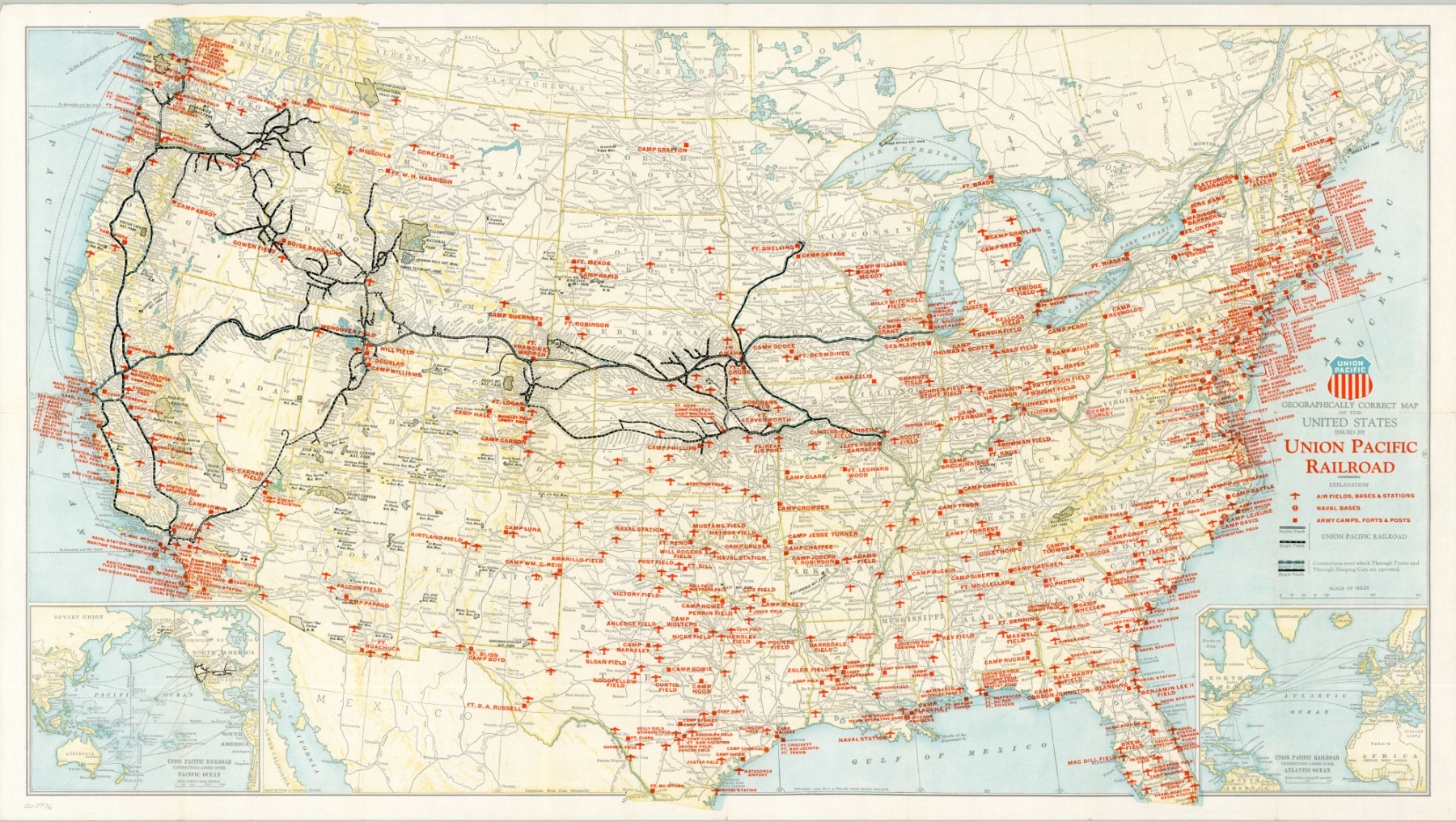
The military might of the United States in context to the lines of the Union Pacific Railroad.
1 in stock
Description
Bright red symbols for Airfields, Naval Bases and Army Camps are overlaid across an otherwise basic map of the United States, showing the rail lines under operation by the Union Pacific Railroad. Emanating from terminals in St. Louis and Chicago, the lines branch extensively westward, while text on the verso provides an index of the military posts and their corresponding post office and railroad stations.
The Union Pacific experienced firsthand the tremendous industrial growth in the United States during the war, and issued this map in an effort to promote their lines as a “strategic middle route” in the upcoming years of peace and plenty. Published in Chicago by Rand McNally in 1945.
Map Details
Publication Date: 1945
Author: Rand McNally
Sheet Width (in): 31.60
Sheet Height (in): 17.75
Condition: A-
Condition Description: Creasing and wear along former fold lines, including small holes at fold intersections and tiny tears along the outer edges of the sheet. One 2" tear on the right side has been repaired on the verso with archival tape.
$75.00
1 in stock

