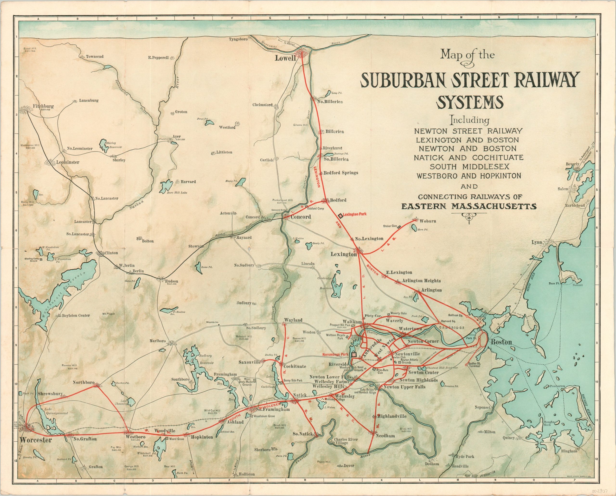
Map of the Suburban Street Railway Systems
The broad network of interurban lines available across eastern Massachusetts in the early 20th century.
Out of stock
Description
This transportation map of a large area in eastern Massachusetts is indicative of the vast networks of suburban street railways enjoyed by many cities in the early 20th century. Boston is shown connected to a variety of suburban locations via several independently operated lines. Towns, landmarks, and steam railroad lines are also noted throughout the image, which was designed and printed by the Rand Avery Supply Company.
The map was published on behalf of the Newton Street Railway (the copyright is held by the manager of the Passenger Department, George Sabin Brush). Photographs and text advertising several locations along the company’s lines can be found on the verso.
Passengers are encouraged to ride “around the ‘hub’ by trolley”, with Newtonville, Massachusetts at its center. A paste-down with several contemporary advertisements can also be found on the verso.
Map Details
Publication Date: 1907
Author: George Sabin Brush
Sheet Width (in): 19.75
Sheet Height (in): 15.90
Condition: A-
Condition Description: Formerly folded into 12 panels, with creasing and light wear along former fold lines. Small holes at fold intersections and a bit of wear on the front panel (verso), which does not affect the image.
Out of stock

