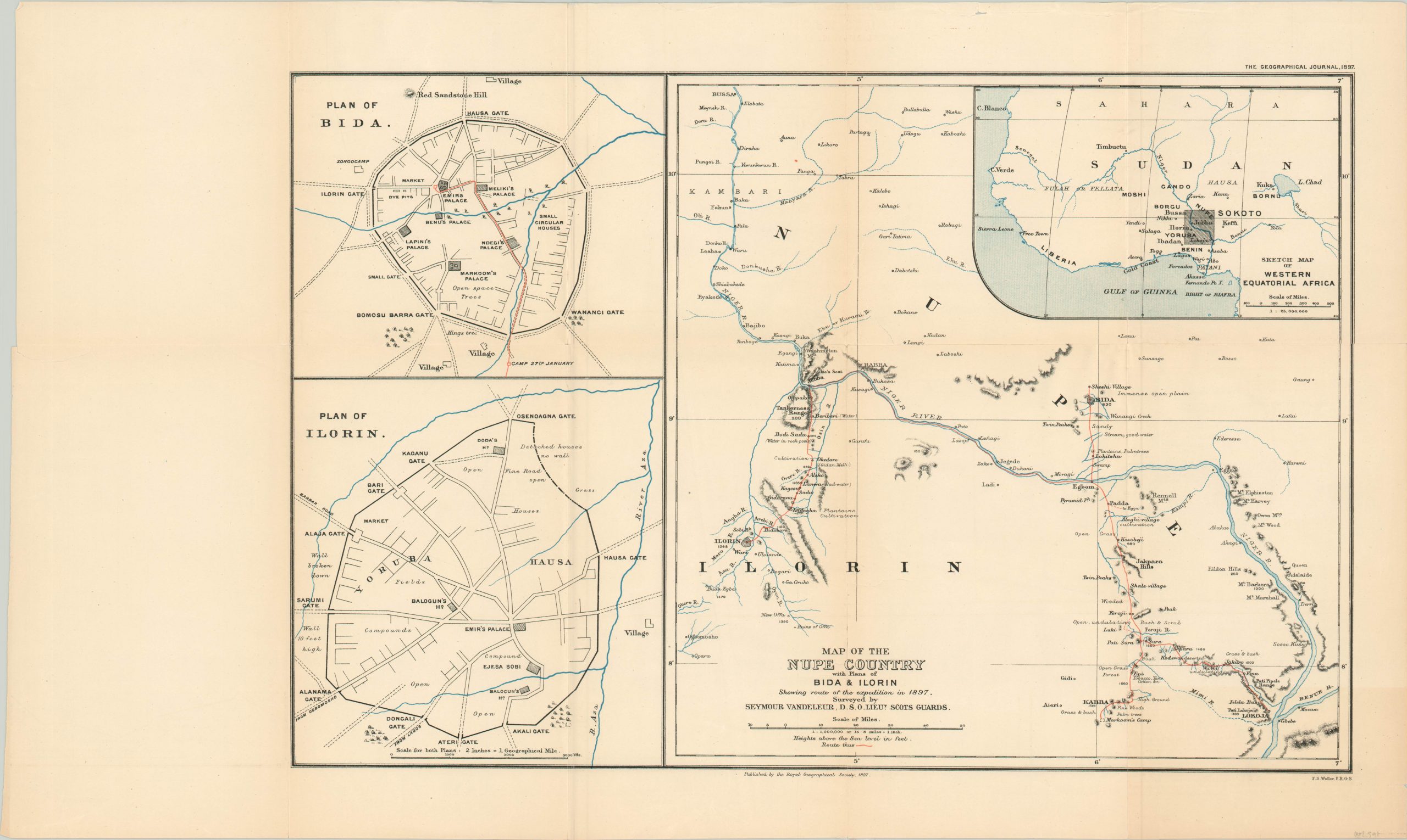
Map of the Nupe Country with Plans of Bida & Ilorin
$200.00
Commercial conquest in the interior of Africa, sanctioned under the guise of exploration.
1 in stock
Description
This fascinating map covers a portion of modern day Nigeria near the confluence of the Niger and Benue rivers. It was published in London by the Royal Geographical Society in 1897, and was included in The Geographical Journal to accompany a paper written and delivered by Seymour Vandeleur of the Royal Scots Guards.
The year prior to publication, Vandeleur accompanied a party of ‘special service officers’ and a guide provided by the Royal Niger Company on an expedition into Africa’s interior. Nominally under the guise of exploration and protection of company assets, the party of cavalry and local porters traveled to the cities of Bida and Ilorin to subjugate the local Emirs and demand the execution of favorable treaties.
For example, after fleeing in fright, the leaders of Ilorin were induced to surrender by force.
“During the interview and the parade of troops which followed, they were very nervous and apprehensive of what might happen to them. The troops were drawn up in the square where the British flag was flying, and a treaty was signed giving complete power to the Niger Company over the country and settlement of the Lagos frontier, and the Emir was reinstated.”
Such thuggery is lost within the image, which shows a simple route in bright red as it cuts through previously unknown territory. Inset plans of Bida and Lorin, two new outposts for the Royal Niger Company, are shown on the left side. A third inset in the upper right provides context on the area that was surveyed by Vandeleur and his men.
Sadly stories such as this were common during the period known colloquially as ‘The Scramble for Africa.’ European interests in the continent grew rapidly during the second half of the 19th century. France had economic or military interests in Tunisia, the British in South Africa, the Portuguese in Mozambique, and the Belgians in the Congo (just to name a few).
German Chancellor Otto von Bismarck, worried his new country would miss out, organized the Berlin Conference in 1884 to formalize and regulate the process of colonization and trade across Africa. This further encouraged European encroachment across the continent, and by the outbreak of WWI nearly 90% of the country had lost its sovereign authority.
Source: Vandeleur, Seymour. “Nupe and Ilorin.” The Geographical Journal, vol. 10, no. 4, 1897, pp. 349–370. JSTOR, www.jstor.org/stable/1774646. Accessed 20 May 2021.
Map Details
Publication Date: 1897
Author: Royal Geographical Society
Sheet Width (in): 24.90
Sheet Height (in): 14.80
Condition: B+
Condition Description: Moderate discoloration and wear along the former fold lines. Numerous areas of separation, including the entire left panel, have been expertly repaired using archival tape on the verso. Remains in good condition as a result, but several tears remain somewhat noticeable within the image and along the seams.
$200.00
1 in stock

