Map of Los Angeles California
$125.00
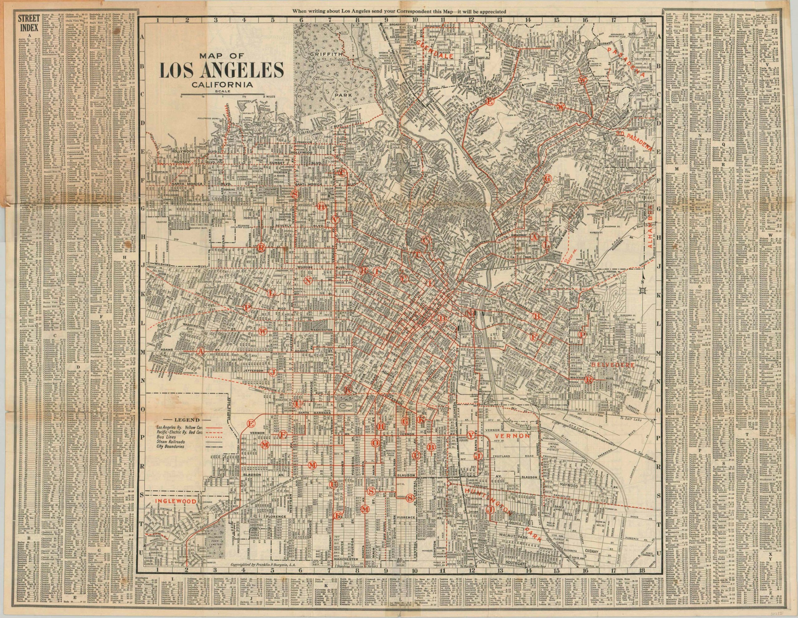
Los Angeles near the height of its electric railway system.
1 in stock
Description
This wonderfully detailed transportation map of Los Angeles is from the Roaring ’20’s, when the automobile became ubiquitous and caused a host of congestion issues for urban centers across the United States. L.A. would respond by building a series of subway tunnels the year following publication, but shortly thereafter electric railways would be replaced with bus routes. Both are shown on the map, with the former dominated by the Yellow Cars of the Los Angeles Railway and the Red Cars of the Pacific-Electric Railway. A comprehensive street index surrounds the image.
The verso includes maps on a variety of scales cover the San Fernando Valley, Santa Monica & Venice Beach, San Pedro & the Los Angeles Harbor, and the downtown Theater District. Copyright by Franklin P. Borgnis and published in Los Angeles by Hill Publishing Co. in 1924.
Map Details
Publication Date: 1924
Author: Franklin P. Borgnis
Sheet Width (in): 27.25
Sheet Height (in): 21.25
Condition: B
Condition Description: Pocket map folded into 24 panels and affixed to original color paper wrappers. Creasing and heavy wear along fold lines, including several areas of separation that have been repaired on the verso with a mix of old cellophane and archival tape. Moderate discoloration present along a few folds, notably in the lower left.
$125.00
1 in stock


