[Indian Reservations in Nevada and Utah]
$250.00
Managing Native American lands in the Southwest during the early 20th century.
1 in stock
Description
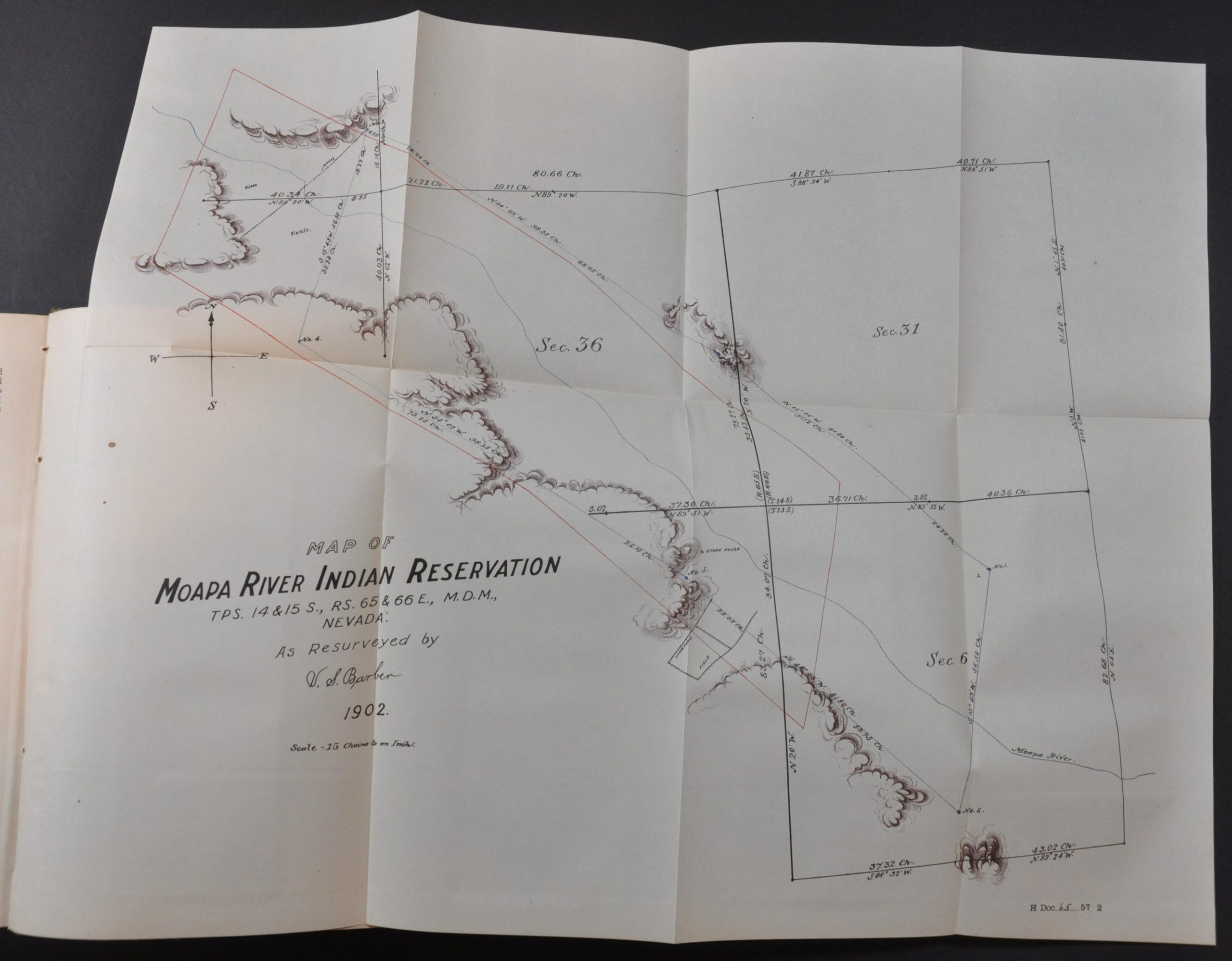
This trio of official maps was published by the Government Printing Office in Washington, D.C. in 1902 as part of a series of miscellaneous bound Congressional reports issued to the House of Representatives. The first sheet, Map of Moapa River Indian Reservation, measures approximately 18″ x 14.25″ and shows the small reservation in southern Nevada located about 40 miles northeast of Las Vegas. It was designed to accompany a four-page letter from the Secretary of the Interior that requested for an additional 236 acres of land to be added to the Moapa Reservation.
The basis of the plea was an error in the original survey, shorting the tribe of its promised 1,000 acres. One excerpt written by Commissioner of Indian Affairs W.A. Jones reads “Should these lands be so occupied in good faith now be restored to the public domain it would cause the Indians having farms and homes thereon to lose such homes and improvements, and thereby give a serious backseat to these Indians, who are making a valiant struggle for self-support.” [pg. 4].
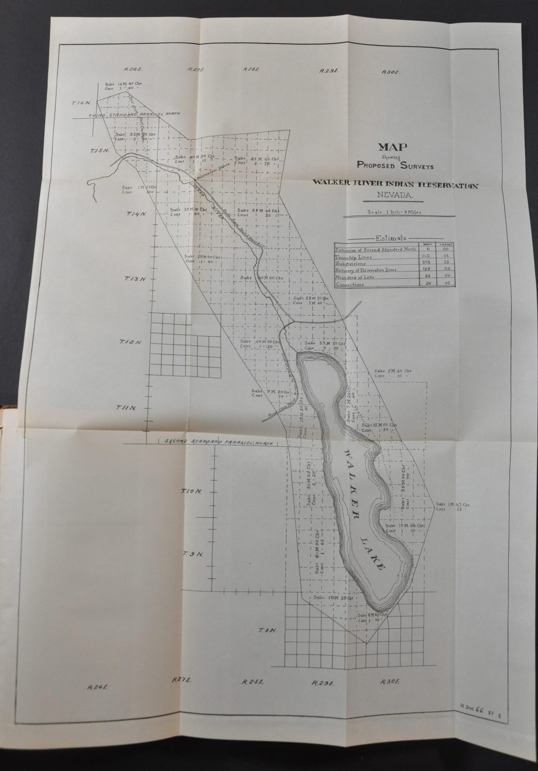
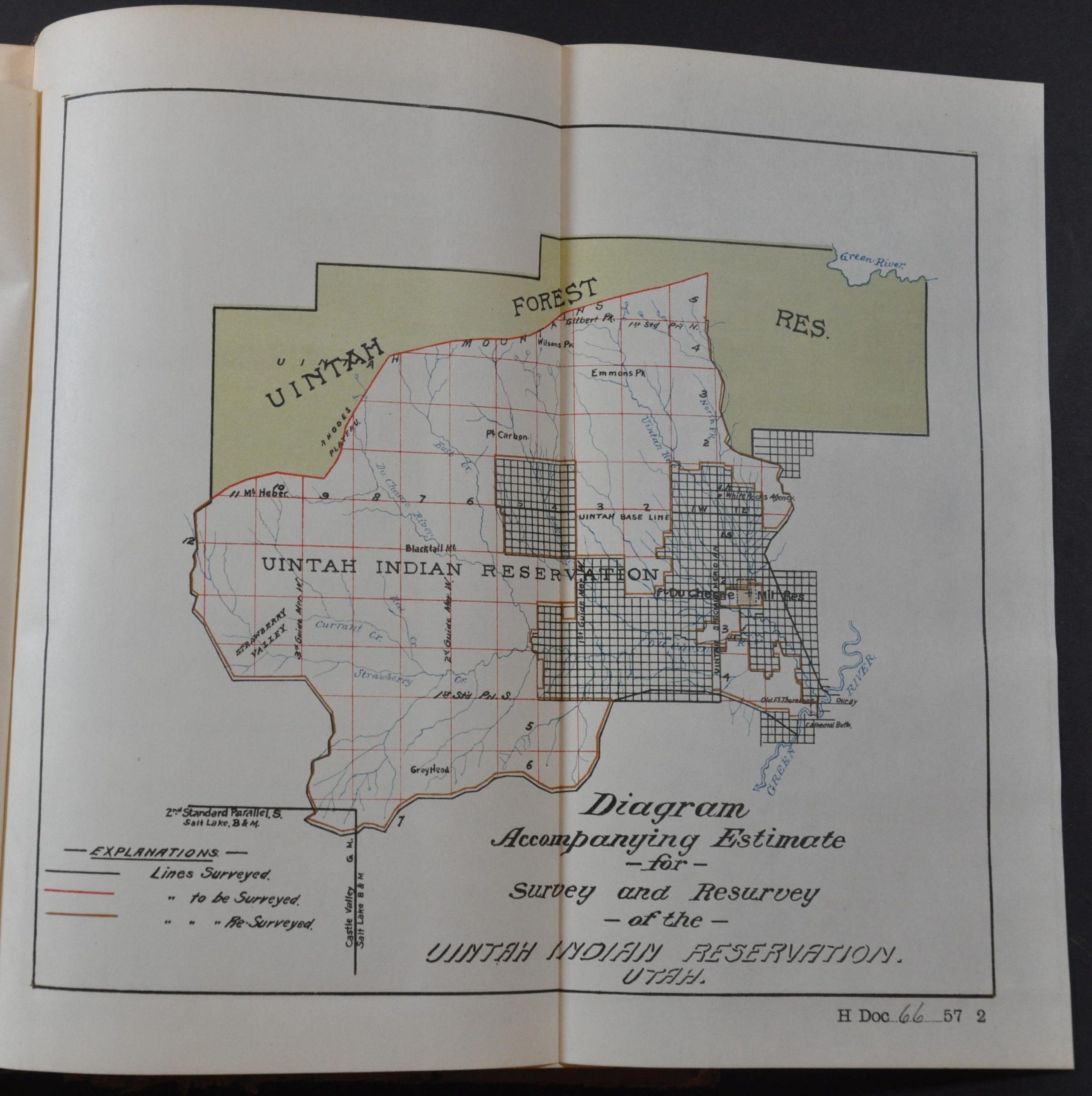
The second map (14.75″ x 21.25″) shows the proposed surveys on the Walker River Indian Reservation in western Nevada, about 100 miles southeast of Reno. The third (10″ x 9″) is titled ‘Diagram Accompanying Estimate for Survey and Resurvey of the Uintah Indian Reservation. Utah.” Both of these are also accompanying a letter from the Secretary of the Interior that is six pages long and contains reports from the Government Land Office.
Other entries in the bound volume (without affiliated maps) include the Annual Report of the Clerk of the House of Representatives, expenditures for the Smithsonian Institution, a list of judgments rendered in Indian depredation cases, and a request from the Secretary of War for appropriations “for damages to private property by gun firing.”
Map Details
Publication Date: 1902
Author: Government Printing Office
Sheet Width (in): See Description
Sheet Height (in): See Description
Condition: A
Condition Description: Two folding maps with creasing and light wear, bound into an unpaginated group of miscellaneous Congressional reports. Original full leather binding with gilt spine is in good condition and contents appear complete. Light toning and a few spots of wear consistent with age and use. Very good overall.
$250.00
1 in stock


