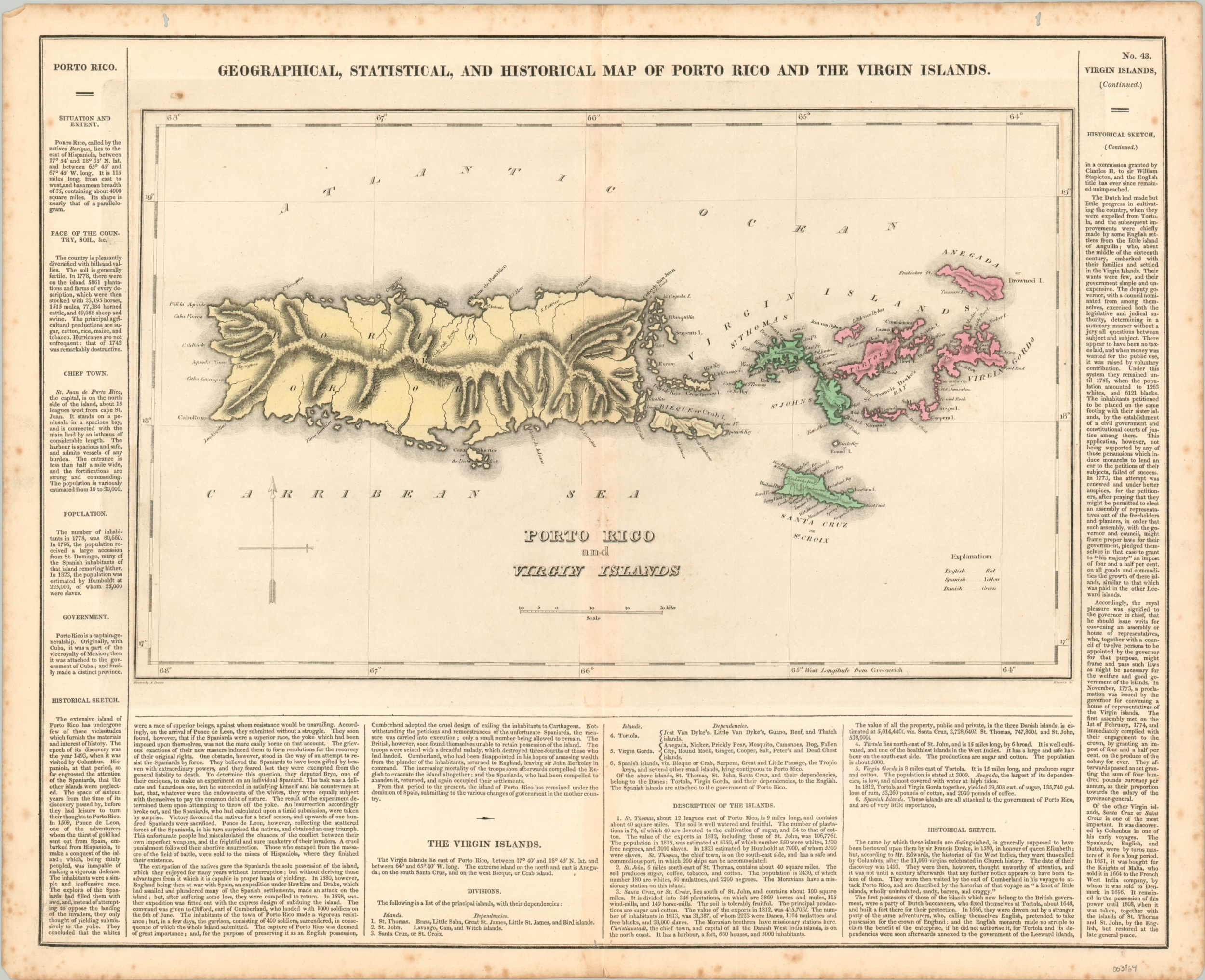
Geographical, Statistical, and Historical Map of Porto Rico and the Virgin Islands
Sparse colonial overview of the Virgin Islands and Puerto Rico.
Out of stock
Description
Though the majority of the South American mainland had overthrown its colonial yoke by the third decade of the 1800s, islands throughout the Caribbean were slower to react to the decline of the Spanish Empire and rising global independence movements. Puerto Rico is shown here, colored in yellow, as one of the last colonial holdings of Spain, while St. Thomas and St. Croix are shaded in the green of Dutch territory and the Virgin Islands are the distinctive red of the British Empire.
Interior detail is surprisingly scarce, save for basic topography in hachure, with place names confined almost exclusively to the coasts. Surrounding the map are numerous paragraphs of text providing additional information on the climate, history, geography, and political organization of the islands.
The map was drawn by Fielding Lucas, Jr. and engraved by Kneass. It was included as sheet number 43 in the 1824 edition of Carey & Lea’s Complete Historical, Chronological, and Geographical American Atlas.
Map Details
Publication Date: 1824
Author: Fielding Lucas, Jr.
Sheet Width (in): 21.5
Sheet Height (in): 17.5
Condition: A-
Condition Description: Moderate spotting visible in the margins and in a few places just within the neatline. Two small wormholes in the upper corner, away from the plate line, and minor wear along the vertical centerfold. Very good overall, with original color.
Out of stock

