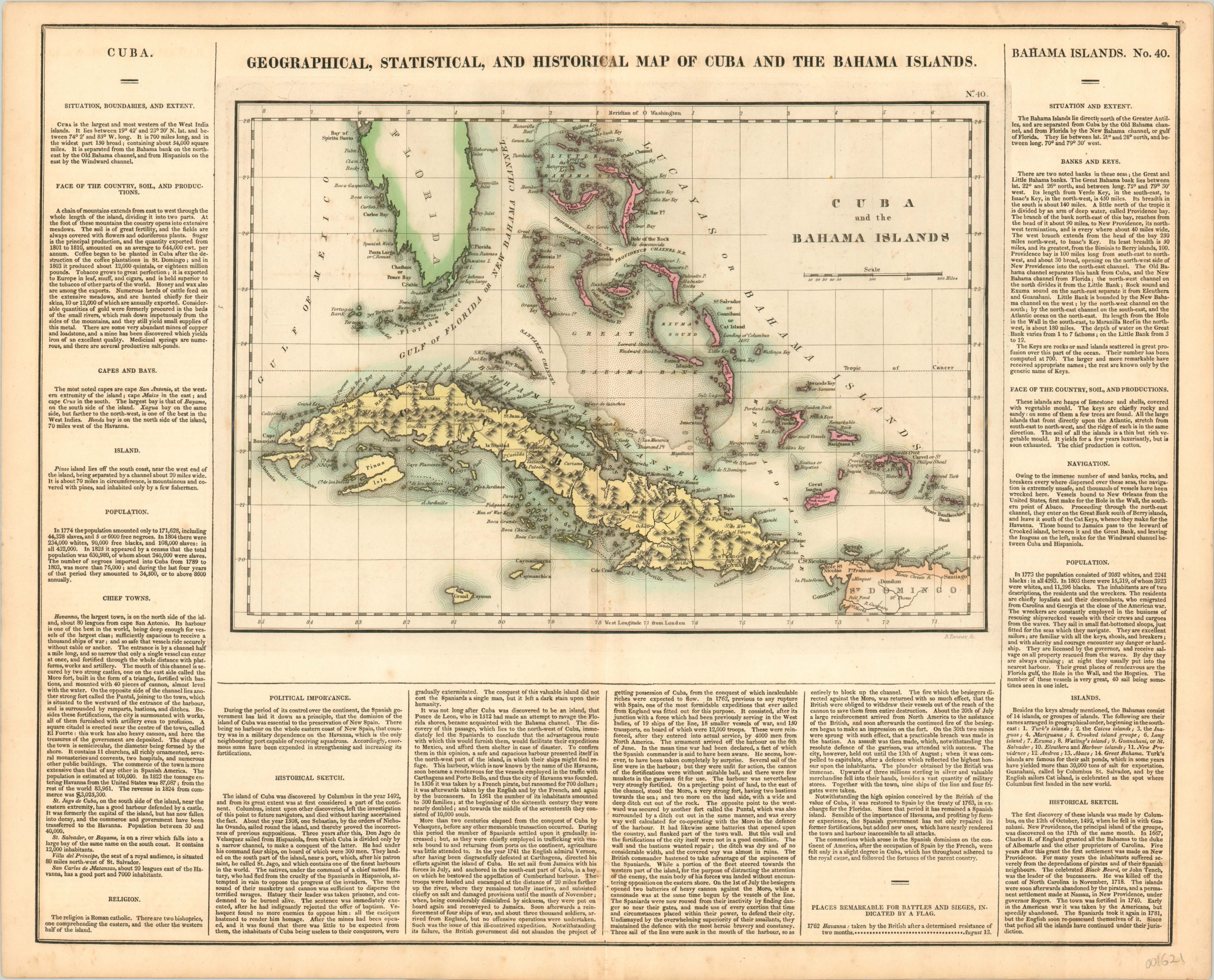
Geographical, Statistical, and Historical Map of Cuba and the Bahama Islands
Original price was: $250.00.$195.00Current price is: $195.00.
Detailed map of Cuba and the Bahamas published at a fascinating period in the history of both.
1 in stock
Description
This eye-catching map of Cuba and the Bahamas provides a fascinating geographic and political overview of the Caribbean islands at a pivotal period in their history. Cuba, still under the yoke of Spanish colonial oppression, was beginning to build a domestic independence movement based on the recent successes of Simon Bolivar in South America. Just a few dozen leagues away, the Bahamas remained a British colonial possession, but were known as a haven for hundreds of black slaves and Native Americans who escaped from Florida after it was ceded to the United States by the Spanish. The site of Columbus’ landing in 1492 is noted on Cat Island.
The map vividly highlights the geographic proximity of the islands that allowed for such close interplay in the early 1820’s. Navigational hazards, sand banks, and pictorial topography highlighting Cuba’s rugged and mountainous interior are also shown. Surrounding the image are numerous paragraphs of text detailing the region’s geography, climate, political organization and history. The map was engraved by B. Tanner and published as sheet number 40 in the 1822 (first) edition of Carey & Lea’s Complete Historical, Chronological, and Geographical American Atlas.
This important American publication was issued in six separate editions and three different languages between 1822 and 1827. It was heavily influenced by an earlier European atlas by Emmanuel Las Cases (published under the pseudonym A. Lesage.), which inspired the format of a base map surrounded by blocks of informative text and tables of statistics.
Henry Carey, a political economist and the son of prominent publisher Matthew Carey, and his brother-in-law Isaac Lea incorporated this novel theme into their atlas, which focused entirely on the countries of the Western Hemisphere. It was issued at a time of tremendous political change in both North and South America, and the detailed maps accompanied by extensive text provide a unique, often insightful, perspective on the problems and possibilities of the Americas in the first quarter of the 19th century.
Map Details
Publication Date: 1822
Author: Carey & Lea
Sheet Width (in): 21.90
Sheet Height (in): 17.50
Condition: A-
Condition Description: A few small spots within the image off the west coast of Florida. Minor discoloration along the vertical centerfold, and one small spot in the upper right corner near the neatline. Very good or better condition overall, with fine original hand color.
Original price was: $250.00.$195.00Current price is: $195.00.
1 in stock

