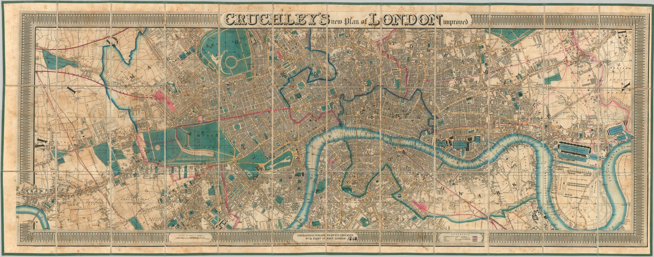
Cruchley’s New Plan of London Improved
A rare example of Cruchley’s improved plan of London from 1848.
Out of stock
Description
George Frederick Cruchley began his publishing career apprenticing at the firm of the influential English cartographer Aaron Arrowsmith. The attention to detail and bold style learned while there clearly extended into his independent publications, beginning in 1823, of which he is best known for the New Plan of London. First issued in 1826, Cruchley would publish successive editions, almost annually, into the early 1850’s. The maps are an important catalog of the urban growth of London, especially in rail travel and urban transportation.
This particular example is from 1848, and shows the city extending from Hammersmith in the west to Blackwell in the east. The boundaries of London, Westminster, and Southwark are boldly colored and identified in the legend in the lower right center. The key also notes railroads in reddish-brown, which can be seen extending to numerous stations, highlighted in pink. Because the map was issued at a relatively large scale of 5″:1, it allows for the individual labeling of street names, prominent public buildings, local industries, parks, and landmarks. Surrounding the image is a bold piano key border containing the title block, scale, legend, and publisher’s advertisements.
This particular example appears to be scarce, with only the 1845 version appearing in Howgego and no exact matches in OCLC. Based on the large, incomplete text on the extreme left and right edges, it’s possible the map was a separately published portion of a larger edition of Cruchley’s “Environs of London” Map, issued the same year.
References
Howgego, J. L. (1978). Printed maps of London: Circa 1553-1850. Folkstone, Kent: Dawson.
Hyde, R. (1975). Printed maps of Victorian London: Folkstone: Dawson.
Map Details
Publication Date: 1848
Author: G.F. Cruchley
Sheet Width (in): 56.25
Sheet Height (in): 22.00
Condition: B
Condition Description: Dissected into 36 panels and mounted on linen. Moderate toning visible throughout the maps' image, concentrated most prominently on the left half of the sheet. There are also several areas of concentrated soiling in the margins, border, and title blocks. Despite the visual flaws, the map remains very presentable; totally intact on strong linen, with bright hand color. The accompanying green cloth covered slipcase is in near fine condition, with the original bold yellow publishers stamp still affixed.
Out of stock


