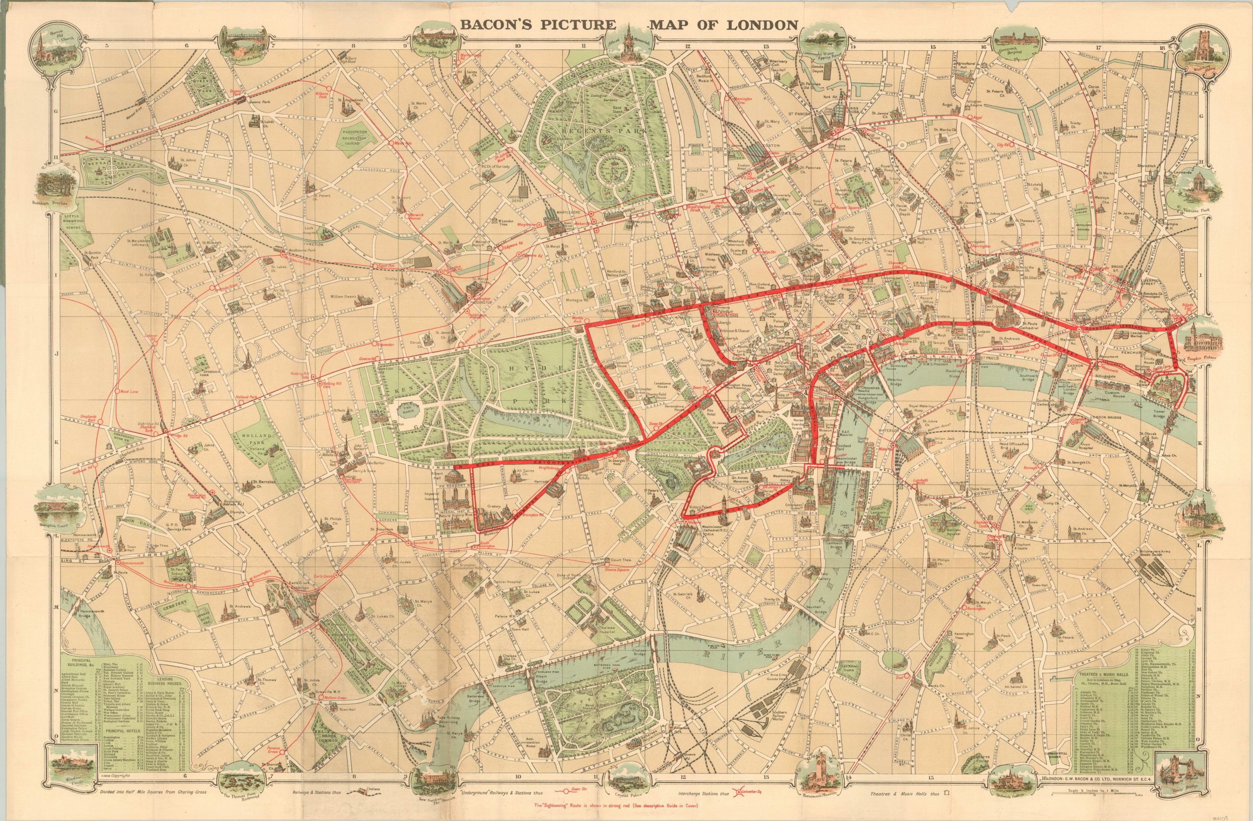
Bacon’s Picture Map of London
$75.00
Pictorial pocket map of London’s interwar period.
1 in stock
Description
This map of London, issued in the middle of the 1920’s by the firm of G.W. Bacon & Company, is focused on the city center from Tower Bridge to Hammersmith Bridge and north to Regent’s Park. It emphasizes a suggested tourist itinerary, which is outlined boldly in red and detailed more thoroughly in the accompanying Sightseer’s Guide (attached to the front cover).
The “picture map” in the title is taken from the numerous illustrations of prominent buildings and locations of interest across the city and in the outer border. Indices in the lower corners provide the location of theaters, music halls, hotels, principal attractions and leading business houses. Details on transportation routes are also provided, though only primary roads are labeled – the accompanying text also includes a comprehensive street index.
Up to date information would have been an important tool to the contemporary traveler, as London experienced its most rapid geographic expansion in the interwar period of the 1920’s and 1930’s.
Map Details
Publication Date: c. 1924
Author: G.W. Bacon & Co.
Sheet Width (in): 37.00
Sheet Height (in): 24.50
Condition: B
Condition Description: Scattered wear along fold lines, concentrated most heavily along the left third of the sheet. A few separations along horizontal folds and small tears at fold intersections and along the outer edge. The map is mounted on linen and folds into 28 panels. With original green paper covers, which are somewhat faded and worn, but in good shape overall.
$75.00
1 in stock

