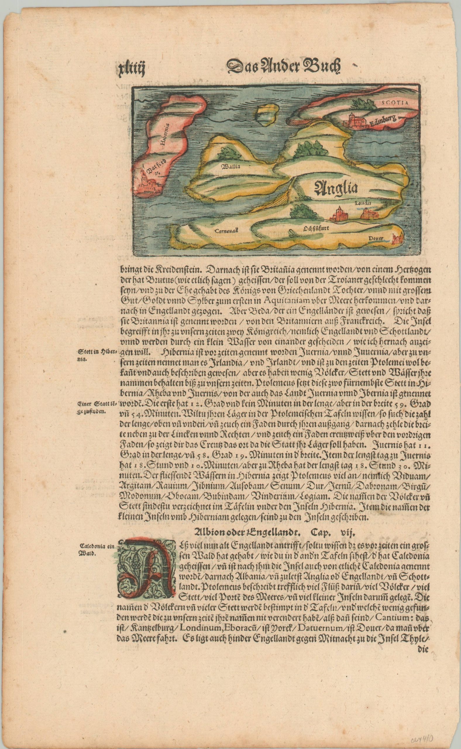
Anglia [United Kingdom]
$150.00
Medieval Europe to a Renaissance audience.
1 in stock
Description
This attractive woodcut map of the modern-day United Kingdom presents the distinct territories of Anglia (England), Hibernia (Ireland), Wales (Aailia), Cornwall, and Scotia (Scotland). Only a handful of prominent cities are labeled – Dover, London, Windsor, Edinburgh, and Waterford – all of which played an important role during the Norman Conquest and the War of the Roses. Accompanying text, in German, provides further information on the historical geography of the islands.
The map was likely published in Basel around 1588 as part of Sebastian Munster’s Cosmographia. The Cosmographia, first published in 1544, was one of the most important texts of the 16th century and influenced geographic thought for generations of scholars and mapmakers. According to Magdalena Peszko of the British Library;
“The Cosmographia is a compendium of historical and geographical knowledge compiled from information gathered as part of Münster’s personal research, international collaborations and editions of the classical authors. The work was based on up-to-date knowledge and provided the geographical and historical overview of the world, natural history, topographical features, boundaries and administrative division of the described lands, their inhabitants, flora and fauna.“
Sources: British Library Blog; Columbia University;
Map Details
Publication Date: c. 1588
Author: Sebastian Munster
Sheet Width (in): 8.25
Sheet Height (in): 13.4
Condition: A-
Condition Description: Small map, approximately 5.3" x 3.1" on a single sheet. Printed on strong paper with modern hand color. Very good condition, with light wear around the outer edges of the sheet and faint spotting visible in the margins.
$150.00
1 in stock

