A Pictorial Map of the United States
$125.00
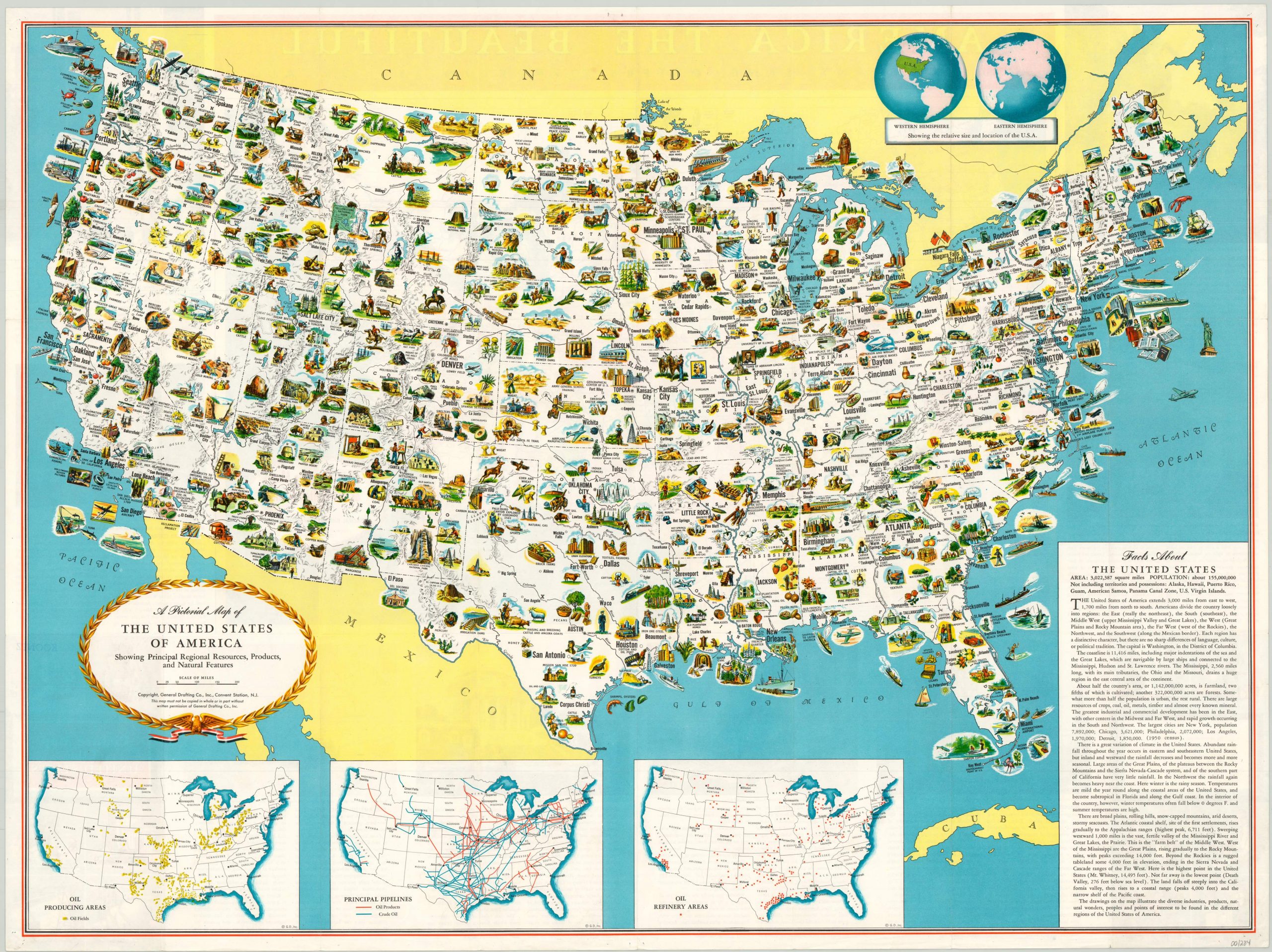
A visual representation of American postwar prosperity.
1 in stock
Description
Designed by the General Drafting Company and published by the Esso (S-O, a company created from the dissolution of Standard Oil) Oil Company in the mid 1950’s, this pictorial map highlights the industrial, agricultural, and recreational bounty of the postwar United States.
Small, charming illustrations showing all that America has to offer can be found in every state and along every coast. Emphasis and priority is given to regional exports and local financial engines like manufacturing, produce, etc., but numerous prominent landmarks are also featured; blurring the distinction between cultural identity and economic development. Three insets at the bottom of the sheet show oil production, refineries and pipelines across the United States.
According to text on the verso, the map was designed to be hung in a classroom and was distributed freely simply by inquiring with Esso’s marketing department. By broadly circulating material such as this, a global oil company was able to successfully associate their financial success with the economic well-being of an entire nation!
Map Details
Publication Date: c. 1955
Author: General Drafting Company
Sheet Width (in): 35.90
Sheet Height (in): 23.90
Condition: A-
Condition Description: Originally folded into a 24 panel brochure. Creasing along original fold lines and a few pinholes in the outer margins from where the map was previously hung. Otherwise in excellent condition.
$125.00
1 in stock