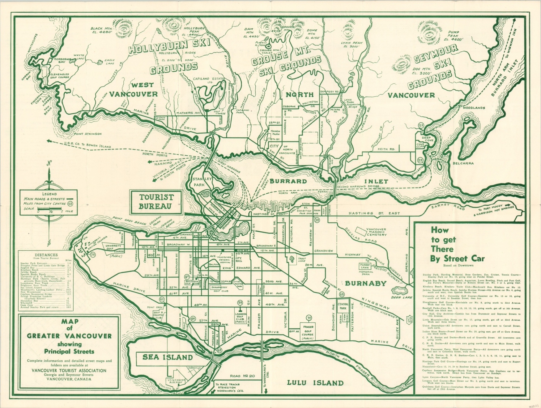
Map of Greater Vancouver showing Principal Streets
$90.00
Tourist map of Vancouver issued for the city’s 60th anniversary.
1 in stock
Description
Come visit ‘Canada’s Evergreen Playground’ with this postwar map of Vancouver, British Columbia. It was published in 1946 by the Vancouver Tourist Association to celebrate the city’s Diamond Jubilee – the 60th anniversary since its incorporation. A simple outline map shows primary transportation routes, major buildings, golf courses, ski grounds, and other locations throughout the greater metropolitan area.
Tables provide text directions to major attractions from downtown and distances from the tourist bureau to various points of interest across the city. An inset map of the downtown area, business directory, summary of what to see, historic events, and facts of interest are all provided on the verso.
Map Details
Publication Date: 1946
Author: Vancouver Tourist Association
Sheet Width (in): 23.7
Sheet Height (in): 17.9
Condition: A-
Condition Description: Creasing and light wear along originally issued fold lines, including small pinholes at fold intersections and tiny tears along the outer edge of the sheet. Remains in very good condition overall.
$90.00
1 in stock